Dangerous heat, severe weather possible across Maryland Tuesday

Maryland will experience high temperatures Tuesday afternoon and severe weather in the evening.
During the peak heat of the day, feels like temperatures will reach as high as 107°.
A Severe Thunderstorm Watch is in effect for Anne Arundel, Baltimore, Carroll, Cecil, Charles, Frederick, Harford and Howard counties, and Baltimore City through 9 p.m.
We have an unsettled pattern of heat and storms that will continue through the upcoming weekend.
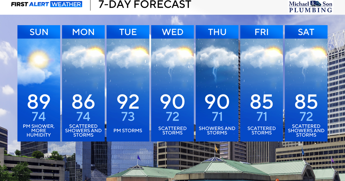
High temperatures in Maryland
A heat advisory has been issued for counties along and east of Interstate 95 Tuesday for a dangerous round of heat and humidity.
Counties included in the heat advisory are southeastern Baltimore and Harford counties along with all of Cecil, Anne Arundel, Kent, Queen Anne's, Talbot, and Caroline counties.
In these areas, feels like temperatures will reach between 100° to 107° during the late morning through the afternoon. It's important to stay hydrated, take frequent breaks in A/C if possible, and check in on pets, friends, family, and the sick and elderly.
High temperatures today will top out in the lower to middle 90s across our entire area.
Risk for severe weather in Maryland
Not only have Alert Days been issued for tough heat and humidity, but also for the potential for severe thunderstorms and flash flooding.
A Flood Watch has been issued for the entire WJZ viewing area, which includes the following counties: Carroll, Baltimore, Baltimore City, Harford, Cecil, Howard, Anne Arundel, Kent, Queen Anne's, Talbot, and Caroline counties.
In these areas, rainfall rates may reach two inches per hour. While not everywhere will see flooding later today, everywhere needs to be prepared for the possibility of flooding from strong thunderstorms. Remember if you see flood waters, turn around, don't drown.
Today's risk of severe weather and flooding is greatest from 2 p.m. until 8 p.m. Clusters of showers and strong to severe thunderstorms will be developing across western Maryland around midday and then they'll push eastward into our area this afternoon into this evening.
The greatest risk from these possible severe storms will be damaging winds, intense lightning, and flooding downpours.
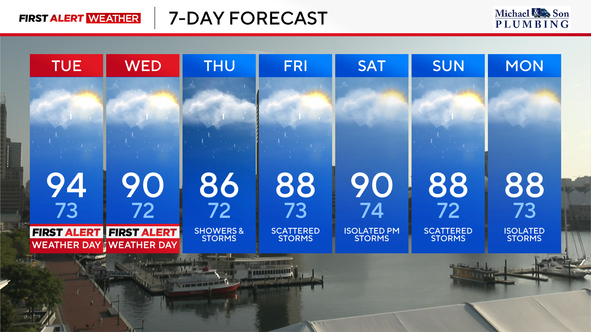
Wednesday will play out in a similar fashion. The heat and humidity will impact us during the morning into early afternoon hours followed by the chance of strong to severe storms during the late afternoon and evening hours. Any storm on Wednesday may also contain flooding downpours and strong to damaging winds. Storms on Wednesday may develop a bit later with the greatest risk between 4 p.m. and 10 p.m.
Heat, humidity, and storms into the weekend
From Thursday into the upcoming weekend, the heat won't be as extreme, but we're still going to be sweating it out with tropical levels of humidity.
The intense heat should break Thursday with additional cloud cover, along with the chance for showers and thunderstorms, which will keep our highs below 90°. Any storm that does develop could bring us very heavy downpours with the possibility of street and urban flooding.
As we head from Friday into the weekend, we're still looking at seasonable levels of heat with highs close to 90°. Factor in the humidity, and feels like temperatures will stick into the middle to upper 90s, so make sure to stay hydrated.
We have a chance of showers and storms Friday. Saturday the showers and storms should be fairly isolated, so it's our pick of the weekend. Another cold front approaches Sunday bringing the chance of widespread showers and storms later in the day Sunday.