Maryland launches map to track flooding events as they become more frequent


Maryland residents can track flooding events through a new map created by the state's Department of Natural Resources (DNR).
The new tool comes as parts of the state experienced heavy flooding this week, and as more heavy rain is expected.
Tracking floods in Maryland
The map allows residents to see potential flooding and sea level changes in Annapolis, Baltimore, Ocean City and other parts of the region.
Residents can also enter an address to explore flood risks in their community.
According to , coastal flooding is an increasing hazard in Maryland, as the number of minor flood days in Annapolis has quadrupled between the 1970s and 2025.
The data projects an average of 18 flood days in Baltimore in 2025, compared to 68 flood days projected for 2040. This would be a nearly 277% increase.
"Knowledge is our greatest defense, and the Flood Explorer puts the latest coastal flood science directly into the hands of the public," said Natalie Snider, Director of DNR's Watershed and Climate Services.
The tracker predicts flood depths using data about elevation and sea-level rise projections. It also provides residents with resources for developing flood plans and identifying vulnerable areas for restoration projects.
"Understanding our flood risk is the first step to building resilience, whether it's securing your own home with flood insurance or a living shoreline, or as a community through nature-based solutions and resilience projects," Snider said.
Flood prevention in Maryland
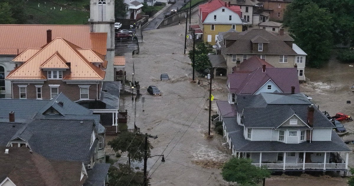
Severe weather on Monday, July 14, caused flooding in some parts of Annapolis and Howard County.
In Annapolis, streets along City Dock closed as flood waters rose. The city has made strides in flood prevention. In April, workers began a $100 million renovation of the City Dock, which includes plans for flood barriers.
Howard County leaders shut down roads in historic Ellicott City earlier in the day in preparation for flooding Monday evening.
The area has seen several deadly flood events in recent years, including in 2011, 2016, and 2018.
In response, the county launched a mitigation program that warns residents of potential floods and clears debris from waterways after heavy rain.
The Ellicott City Safe and Sound plan also includes the construction of seven retention ponds and tunnels, two of which are complete. A third tunnel is expected to be completed in fall 2027 and will be able to collect 26,000 gallons of water per second.