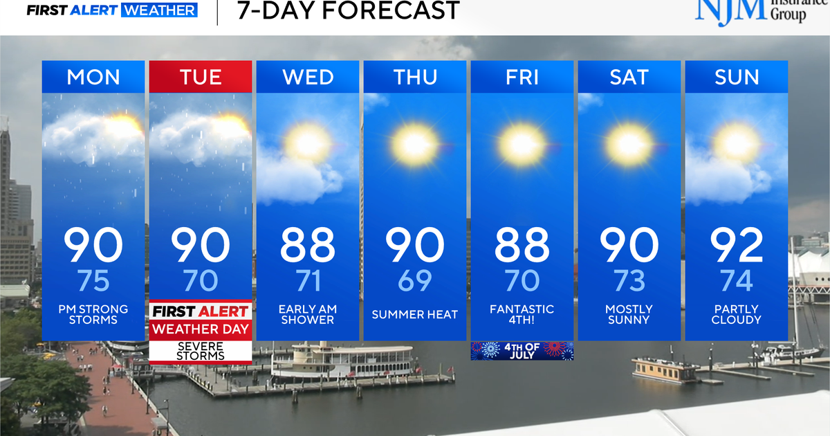
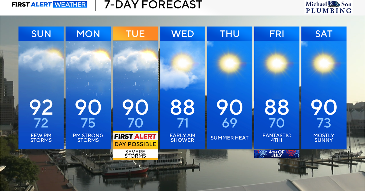
Severe weather expected Monday, Tuesday in Maryland

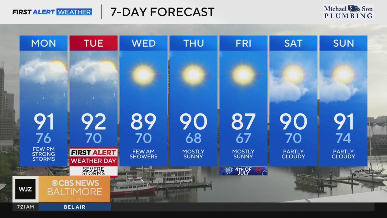
Severe weather is possible across parts of Maryland Monday evening, primarily west of the I-95 corridor.
While not everyone will see the isolated strong to severe thunderstorms, those that do develop may produce damaging wind gusts and heavy downpours.
Temperatures, after climbing to around 90 degrees this afternoon, will gradually fall into the 70s overnight. Any lingering storm activity is expected to diminish after sunset.
Severe Thunderstorm Warnings are in effect for Baltimore and Harford counties until 5:15 p.m. The storms are expected to bring strong wind gusts, heavy rain, and the potential of knocking down trees and power lines.
Tuesday Alert Day for severe weather
A more widespread and potentially more impactful round of severe weather is expected Tuesday. The WJZ First Alert Weather Team has issued an Alert Day due to the increased threat of damaging winds and localized flooding.
Storms are forecast to develop by mid-afternoon and will progress eastward through the evening hours, affecting the Baltimore metro area during the evening commute and reaching the Eastern Shore before tapering off after sunset.
High temperatures Tuesday will once again reach near 90 degrees, with heat index values approaching 100 prior to the arrival of storms. In addition to damaging winds, "training" thunderstorms — storms repeatedly moving over the same areas — could result in isolated flooding.
Weather conditions improve for July 4
The unsettled pattern will begin to ease Wednesday, though a lingering chance for showers or a thunderstorm remains across southern Maryland and the lower Eastern Shore. Elsewhere, dry conditions are expected with highs in the upper 80s and slightly reduced humidity.
The forecast improves further for Thursday and Independence Day. Nights will feel more comfortable, with lows dipping into the upper 60s, while afternoon highs stay in the upper 80s under mostly sunny skies.
Looking Ahead: Warm, Mostly Dry Weekend
Dry and sunny conditions will continue into the weekend, with highs near 90. Humidity will gradually build back in, and nighttime temperatures will trend milder — generally in the low to mid 70s.
The next chance for storms returns early next week as the pattern turns more unsettled again.