Heat advisory issued for most of Massachusetts through Monday; maps show how hot it will feel

After a relatively comfortable July 4th, the extreme heat is returning to Massachusetts and the National Weather Service has issued a heat advisory because of how hot it will feel through Monday.
The WBZ Weather Team is implementing a NEW NEXT Weather Alert given heat-related dangers ahead Sunday and Monday.
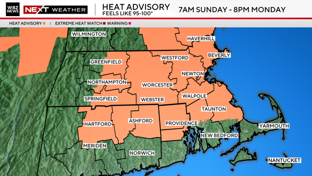
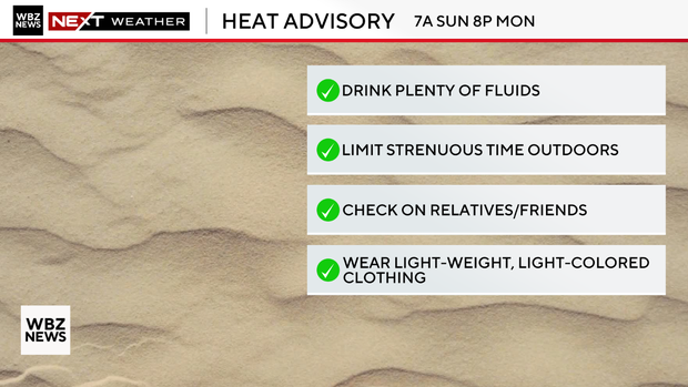
The National Weather Service has issued a heat advisory for most of southern New England Sunday at 7 a.m. through Monday at 8 p.m., given the threat for heat indices of 95-100 degrees.
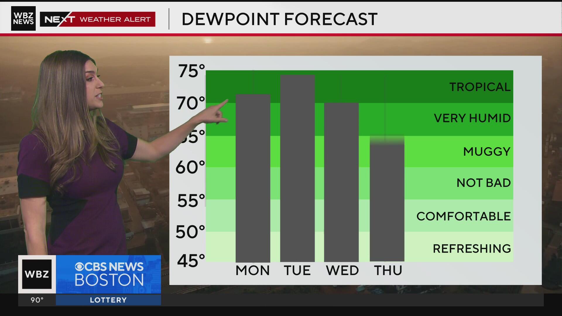
If you combine high temperatures between 90-95 degrees and elevated dew point temperatures, conditions could become fairly steamy, especially for age groups sensitive to heat.
As temperatures begin to climb on Sunday morning, midday through early afternoon conditions could feel stifling but with some minor wind gusts, some relief is expected under shaded areas where a breezy tree canopy could cool the body.
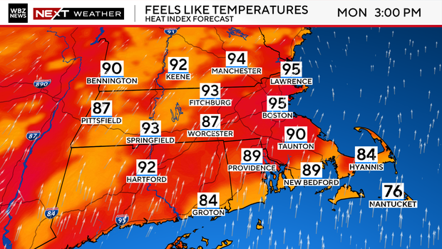
Monday continues a final day of similar conditions as scores of towns and communities will feel like the mid to upper 90s again before a wet pattern ensues throughout the week.
If you're hoping to score another beach day Sunday afternoon, you will find the conditions perfect as ocean temperatures will range from the upper 60s to lower 70s. UV Index values will be high so please remember to apply (and re-apply) sunscreen protection.
In the days ahead, Tuesday will feature spot showers, cloudy skies, and evening thunderstorms. This will help to start a trend towards cooler weather by the end of the week.

A brand new tropical system has a name from the National Hurricane Center - Chantal. This system is not expected to gain too much more strength aside from having a steady rainy and windy thumbprint as it crawls up the Atlantic seaboard.
As Tuesday begins, the outlying bands from this system are expected to spray the region with spot showers Tuesday morning.
However, an approaching cold front from the west will nudge this system back east but also cause steadier rain and rumbles throughout Tuesday late afternoon and evening. This will begin a thread of wet weather and cloudy cover mid to late week next week.