Flash flood in Chicago saw more than 4 inches of rain fall in less than 90 minutes on West Side

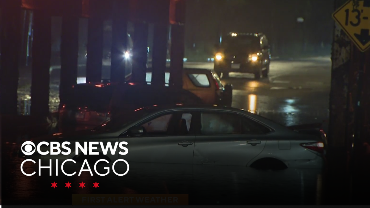
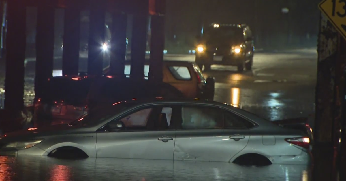
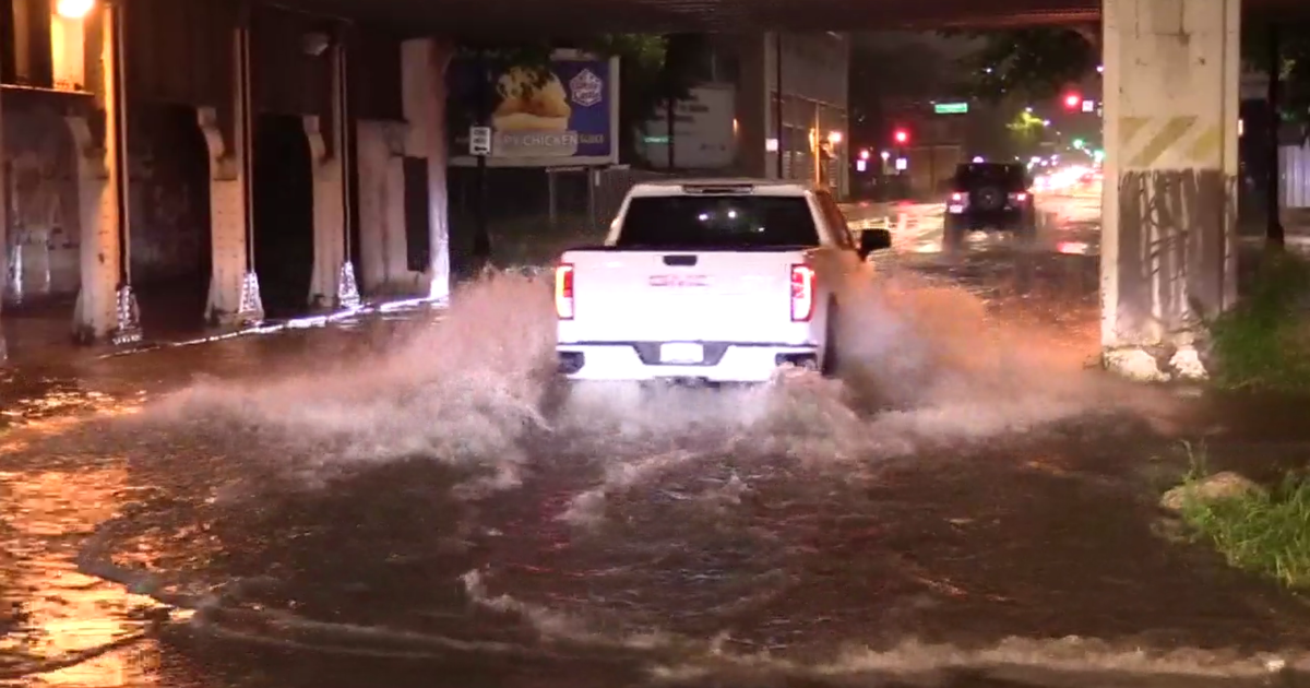
Chicago experienced one of its heaviest rainfall events since September 2023 on Tuesday night, leading to water rescues and flooded basements.
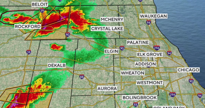
An outflow boundary surging northward into the city from earlier storms south of Interstate 80 led to one lone thunderstorm cell developing over Chicago just before 9 p.m. That boundary then stalled, with thunderstorms drifting eastward over Lake Michigan, but also back-building over the city, until 10:45 p.m. This led to 'training' thunderstorms – heavy rain moving over the same area repeatedly, like a train on the tracks.
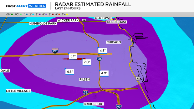
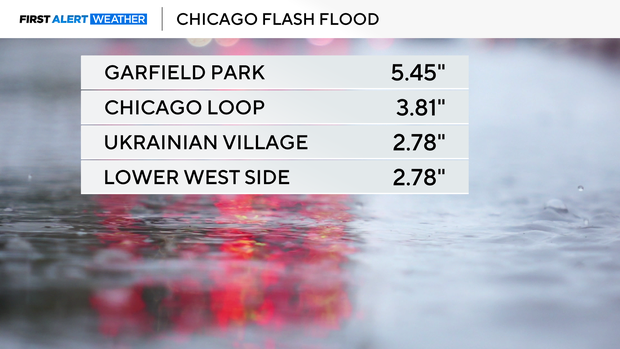
With high levels of moisture in the atmosphere, these storms produced torrential rainfall rates; 4.63 inches of rain fell in less than 90 minutes near Garfield Park, with storm total rainfall there reaching 5.45 inches. Near the Loop, 3.81 inches of rain fell in just under two hours. Radar-estimated rain totals over the Eisenhower Expressway corridor west of downtown Chicago climbed as high as 7 inches. This cell was so isolated, however, that nearby O'Hare and Midway airports recorded just 0.05 inches of rain all evening.
A Flash Flood Warning was issued for central Chicago at 9:46 p.m., then upgraded to a "considerable" Flash Flood Warning that triggers cell phone emergency alert tones at 10:06 p.m. This is the same type of warning and alert triggered in the early phase of the deadly Texas flooding over 4th of July weekend.
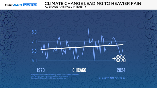
Heavy downpours are getting heavier in a warming climate. For every 1 degree Fahrenheit of warming, the atmosphere holds 4 percent more moisture. This means when it rains, it really pours. Climate Central found that rain intensity has increased by 8 percent in Chicago since 1970.
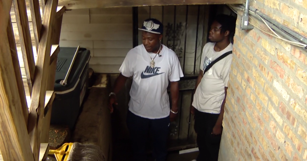
As CBS News Chicago reported in 2024, the warmer climate is leading to more basement flood events and straining the infrastructure that handles storm water.