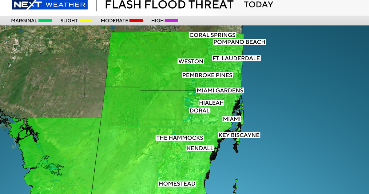
Flood advisory issued for parts of South Florida as storms roll through area, lightning and hail reported

The NEXT Weather Team is tracking a humid and rainy weekend, as a flood advisory was briefly issued for Saturday evening.
The "feels like" temperatures from Key West to Fort Lauderdale will flirt with or surpass the triple digits. It's important to stay inside as much as possible and stay hydrated.
Saturday morning will be cloudy but mostly dry. Pop-up rain storms will start in the mid-afternoon and continue through the early evening hours.
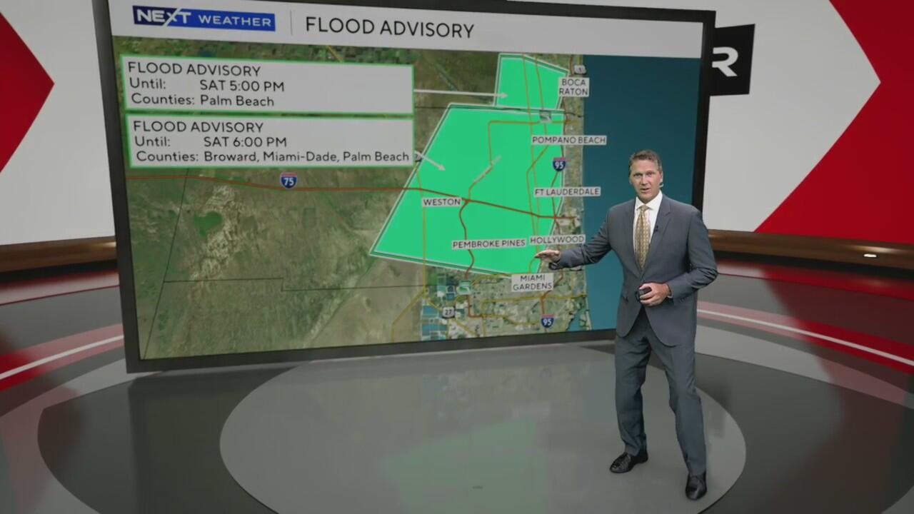
A flood advisory was issued Saturday until 6 p.m. for areas from Sunrise and Pembroke Pines all the way north to Pompano Beach and parts of Palm Beach County until 5 p.m., just west of Interstate 95, as afternoon storms with heavy rain worked through the area.
Lightning, hail, strong wind and very heavy rain were reported on Saturday afternoon as storms developed. The National Weather Service cancelled the flood advisories for Miami-Dade and Broward Counties just after 4:30 p.m.
With a flood advisory, expect some minor flooding and street flooding, as everywhere may be slow to drain. An estimated few inches of rainfall are expected, with some estimates coming from reported hail in Coral Springs and just south of Tamarac.
Rain and lightning were also picked up on the NEXT Weather Radar in southern Miami-Dade County near Homestead, but don't expect these storms to intensify, but conditions may trigger additional storms as cooler air blows through the area.
The storms are not expected to redevelop overnight.
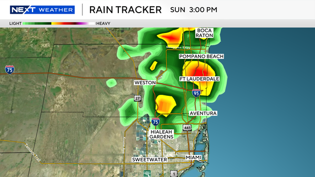
Sunday is expected to be just as rainy in the afternoon.
The rain threat will intensify as we start out the work week with storms rolling through South Florida on both Monday and Tuesday.