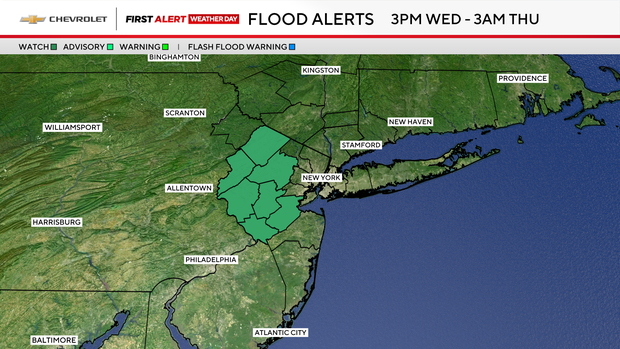
Flood watch for parts of N.J. as communities struggle to recover from storms

There's a flood watch for northwestern parts of New Jersey, where communities are still cleaning up from Monday's storm. A heat advisory took effect Wednesday for much of the New York City metropolitan area.
Click here to check the latest warnings, watches and advisories from the First Alert Weather Team.
Wednesday and Thursday are First Alert Weather Days, as we're tracking heat, humidity and downpours that could lead to localized flooding.
Weather alerts for NYC area today
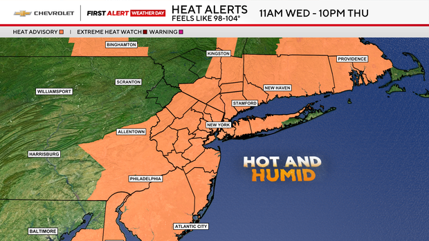
- Heat advisory (much of the area): 11 a.m. Wednesday until 10 p.m. Thursday
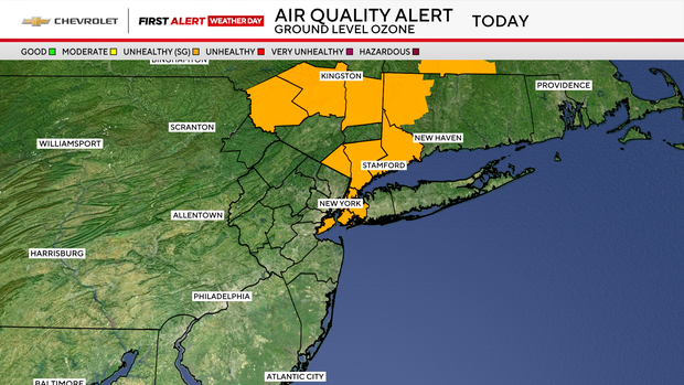
- Air quality alert (NYC, much of the Hudson Valley, and southwest Conn.): 11 a.m. to 11 p.m. Wednesday
- Flood watch (west/northwest N.J.): 3 p.m. Wednesday until 3 a.m. Thursday
Heat and flood risks
Wednesday is looking hot and very humid, with highs near 90 degrees but feeling more like 95.
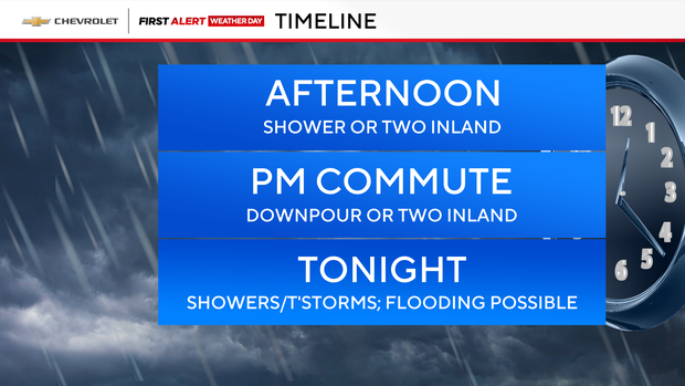
There's a chance of isolated showers or downpours, mainly west of New York City. A few showers or thunderstorms may also push through later tonight, and localized flooding will be possible.
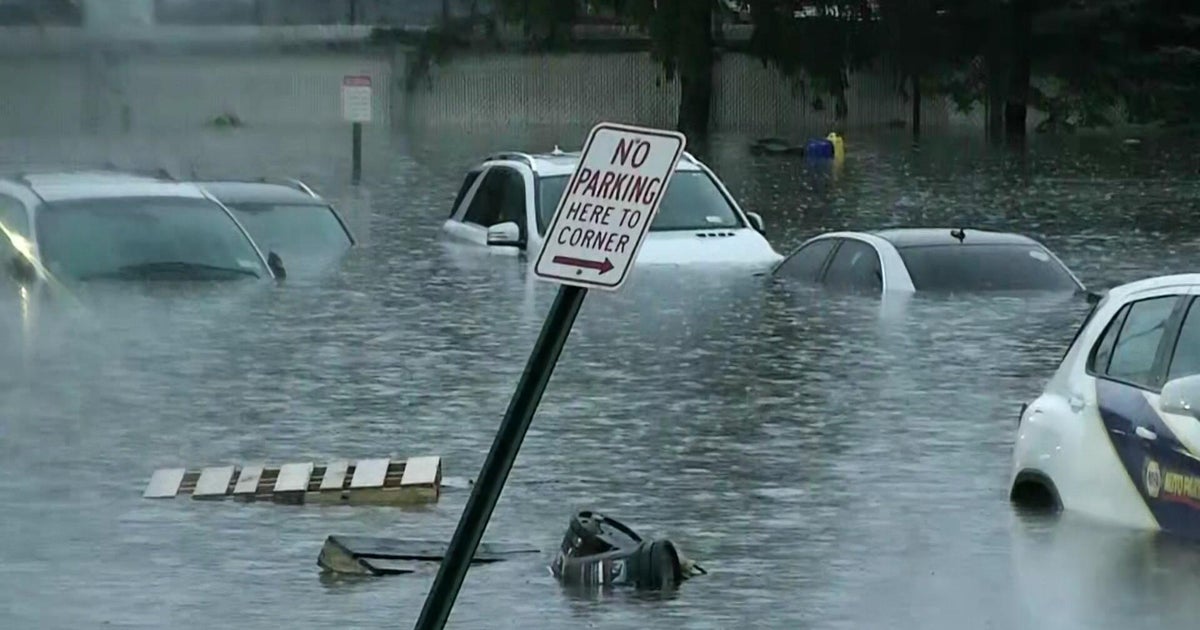
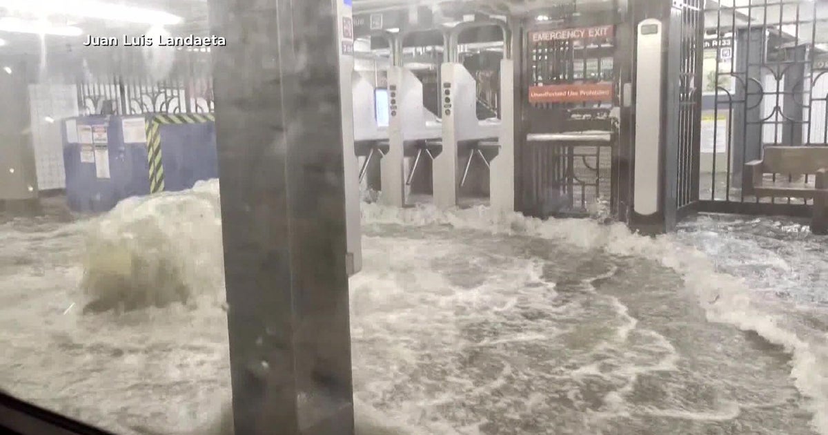
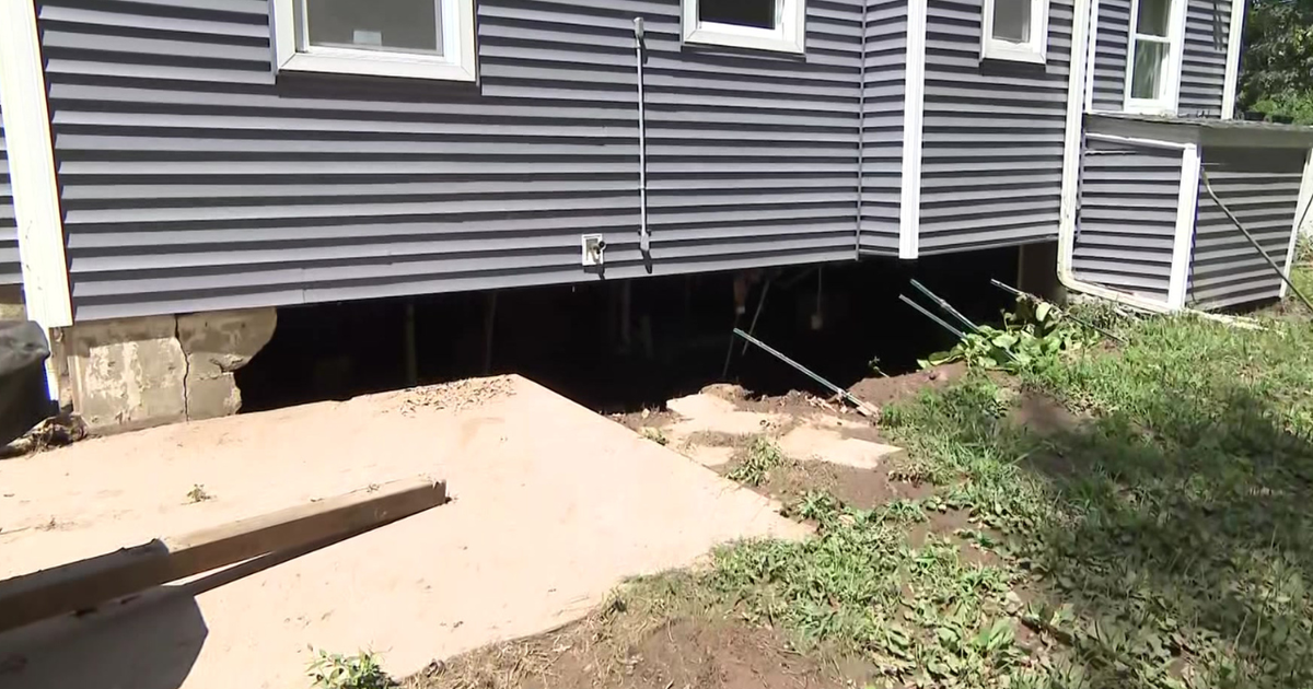
Heavy downpours lead to flash flooding Monday night and devastated communities in Union and Somerset counties in New Jersey. Two people were killed when their car was swept up by the flood waters in Plainfield.
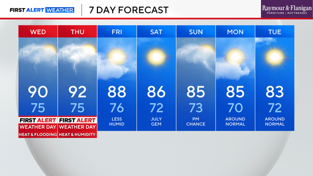
Thursday is also expected to be hot and humid with isolated storms. Highs will be in the low 90s but feel like 95 to 105 degrees.
Temperatures should dip back down into the upper 80s on Friday, so this week may not hit a full heat wave.