High humidity and chance of severe storms around NYC area Sunday

The humid weather returns to New York City on Sunday, along with the risk of some severe storms.
It's a First Alert Weather Day, but it's not expected to be a washout.
Storms expected Sunday evening
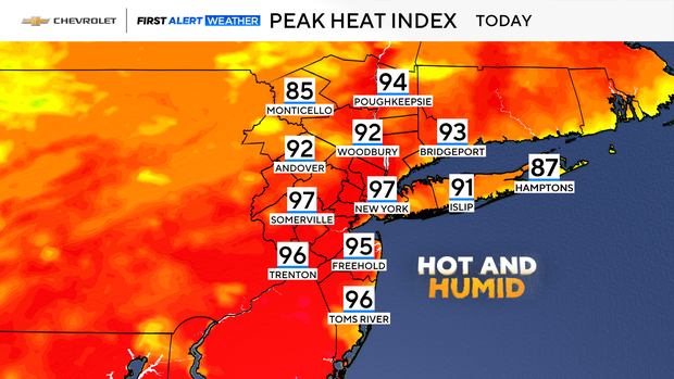
After some early morning showers and storms, especially for the Jersey Shore and Long Island, clouds will give way to some sunshine for midday. Temperatures will climb into the upper 80s and low 90s, with heat indices of 95+ degrees by this afternoon. We're back to that real tropical feel today.
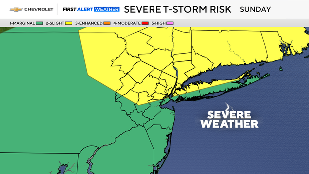
As a cold front approaches, we'll have some more scattered showers and storms popping up by mid-afternoon, continuing into early evening. This is one of those days where not everyone will see them, and they'll be very hit or miss.
With the ample available moisture, any storm could be on the strong side. Gusty winds and brief heavy rain are the main threats. The good news is storm motion will be progressive, so other than localized poor drainage flooding, widespread flash flooding is not a major concern.
Nice week ahead for NYC area
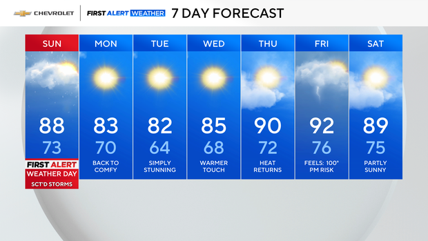
The cold front passes through this evening, with clearing skies tonight. It'll also sweep the humidity away and give way to a beautiful stretch of weather to start the work week. Monday will see falling humidity, ample sunshine, and highs in the low 80s.
The pleasant weather continues Tuesday and Wednesday before heat builds back in by late week.