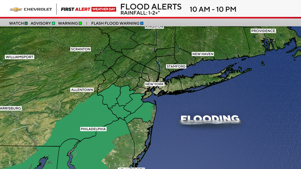
Flash flood watch in Tri-State Area from Tropical Storm Chantal's remnants


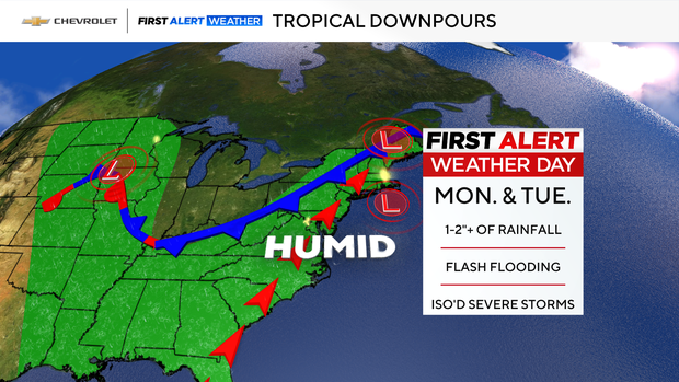
As the remnants of Tropical Storm Chantal stream northward into the Tri-State Area, major weather changes are in store after a near-perfect Fourth of July weekend in New York, New Jersey and Connecticut.
While it won't be constantly raining, heavy, tropical downpours can suddenly occur and may lead to flash flooding on Monday and Tuesday. A few thunderstorms may be severe.
Tropical levels of humidity were in place by Monday morning, as well as elevated chances of heavy rain and thunderstorms throughout the day as a result of Chantal's moisture.
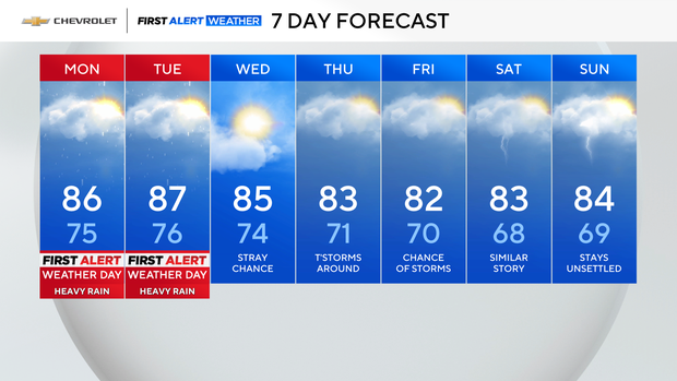
Aside from the threat of downpours, it was another warm day, with highs in the low to mid 80s.
Tuesday forecast
Coverage of showers and thunderstorms will increase even further on Tuesday, as a cold front moves into the very tropical airmass left in place courtesy of Chantal. The severe threat will also ramp up, with torrential downpours being the greatest hazard associated with any thunderstorms that form.
Just like Monday, these downpours could lead to flash flooding.
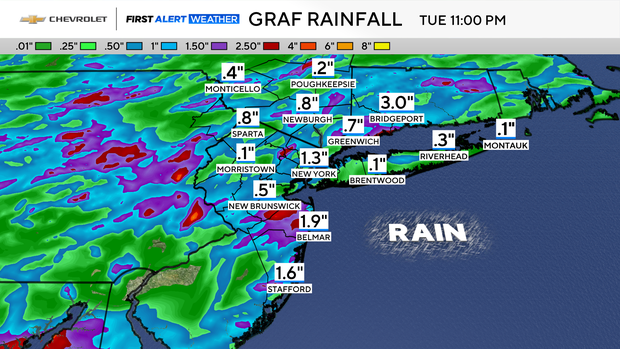
Rainfall is anticipated to range from 1-2+ inches between Monday and Tuesday. However, it's possible some locations will receive much higher amounts, especially if thunderstorms become stationary in their respective locations.
Rain chances will be in the forecast through next weekend. The warm temperatures and elevated humidity levels will stick around as well.