Tuesday will be sunny, hot as Philadelphia region could get severe storms. Here's the forecast.

Tuesday's weather forecast brings two distinct risks to the Philadelphia region — we've issued a NEXT Weather Alert for excessive heat during the day and chances of storms at night.
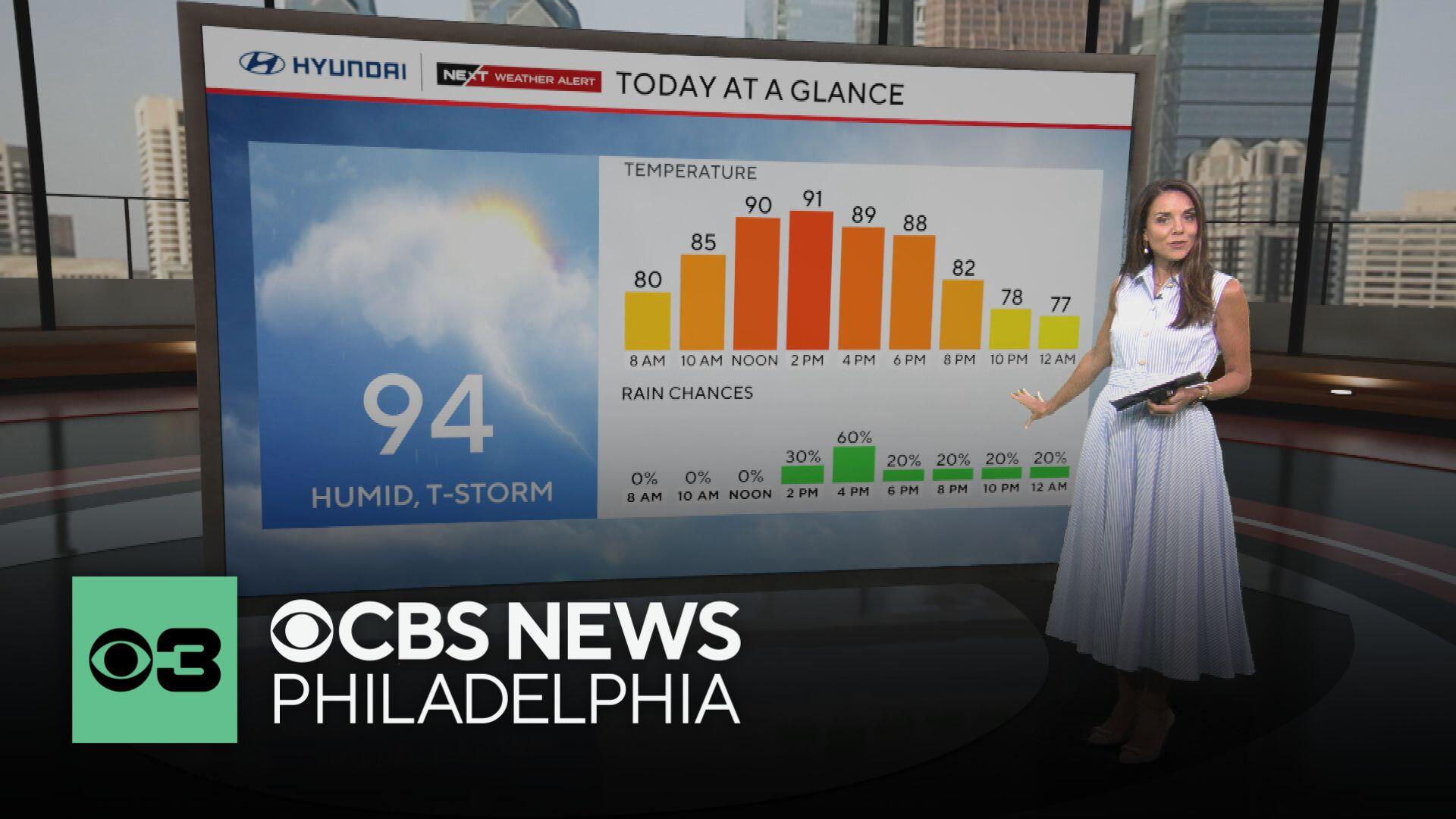
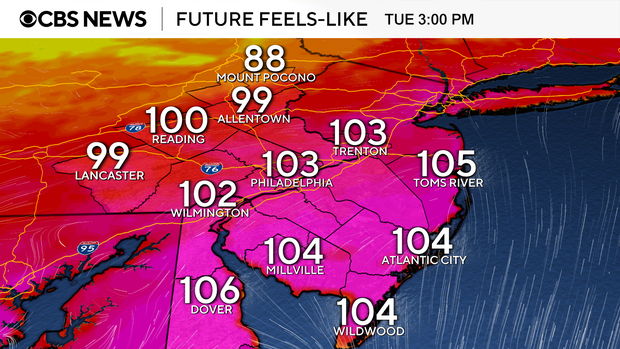
The morning starts calm but incredibly humid, and heating through the day will peak with a high temperature of 94 degrees, which will feel more like 101-104 by mid-afternoon. This combination can put people at risk for heat-related illnesses.
A heat advisory is in effect from 10 a.m. to 8 p.m. Tuesday.
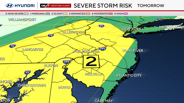
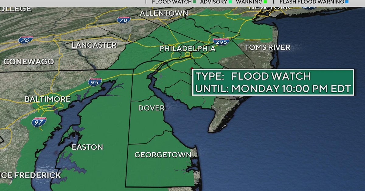
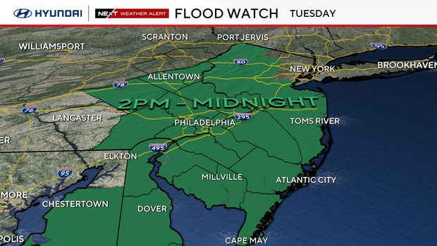
Then, Tuesday evening, we will see a line of strong to severe storms move through the area, packing heavy rain and potentially damaging winds. The region is under a slight risk for severe weather, or level 2 out of 5. The whole region is also under a flood watch, highlighting a possible impact of the storms.
The storms will begin to weaken through Tuesday night, but conditions will remain quite warm and muggy.
The remnants of Tropical Storm Chantal helped usher in the unsettled pattern that we will continue to see through the remainder of the week.
The chance for a few isolated afternoon showers and thunderstorms will return Wednesday afternoon, with even better rain chances through the second half of the week and into the weekend. In fact, this unsettled weather pattern will likely continue into at least the first part of next week.
Here's your 7-day forecast:
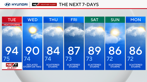
Tuesday: NEXT Weather for heat, storms. High 94, Low 75.
Wednesday: Isolated storm or two.. High 90, Low 74.
Thursday: Scattered storms. High 84, Low 74.
Friday: Scattered storms, High 87, Low 73.
Saturday: Scattered storms. High 89, Low 73.
Sunday: Scattered storms. High 86, Low 72.
Monday: Scattered storms. High 86, Low 72.