Cool and cloudy this Saturday in the Philadelphia region, dodging showers and thunderstorms

This weekend's weather will be downright dreary for fathers and father-like figures across the Philadelphia area.
In addition to air quality alerts for Saturday, We are stuck just north of a stalled front where cooler air is located. Temperatures will run 10-15 degrees below average with highs in the upper 60s to near 70.
Disturbances will also travel along that front, bring a chance of showers and isolated storms.
The weekend won't be a total washout, but have backup plans indoors just in case and carry the umbrella for any passing showers.

Meanwhile, light east winds are spreading smoke and particulates from the wildfire in Wharton State Forest across the region. The clouds act like a lid to trap these pollutants near the surface.
Monday, we continue the dreary and cool pattern with some improving weather by Tuesday.
Wednesday, summer-like weather returns with 80s, sunshine, and scattered afternoon thunderstorms.
Thursday and Friday mark both the end of spring and the start of summer. Both days will be sunny and hot with highs in the upper 80s and low 90s.
Currently our first weekend of summer looks dry, sunny, and hot.
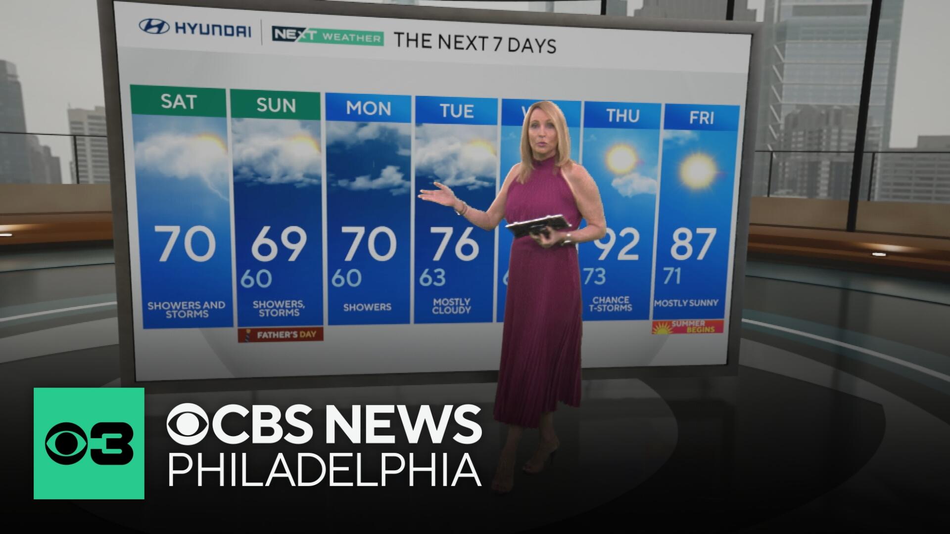
Here's your 7-day forecast:

Saturday: Showers, storms. High 70. Low 65.
Sunday: Showers. High 69. Low 60.
Monday: Showers. High 70. Low 60.
Tuesday: Clouds, showers. High 76. Low 63.
Wednesday: Some sun. High 87. Low 67.
Thursday: Heating up. High 92. Low 73.
Friday: Mostly sunny. High 87. Low 71.


