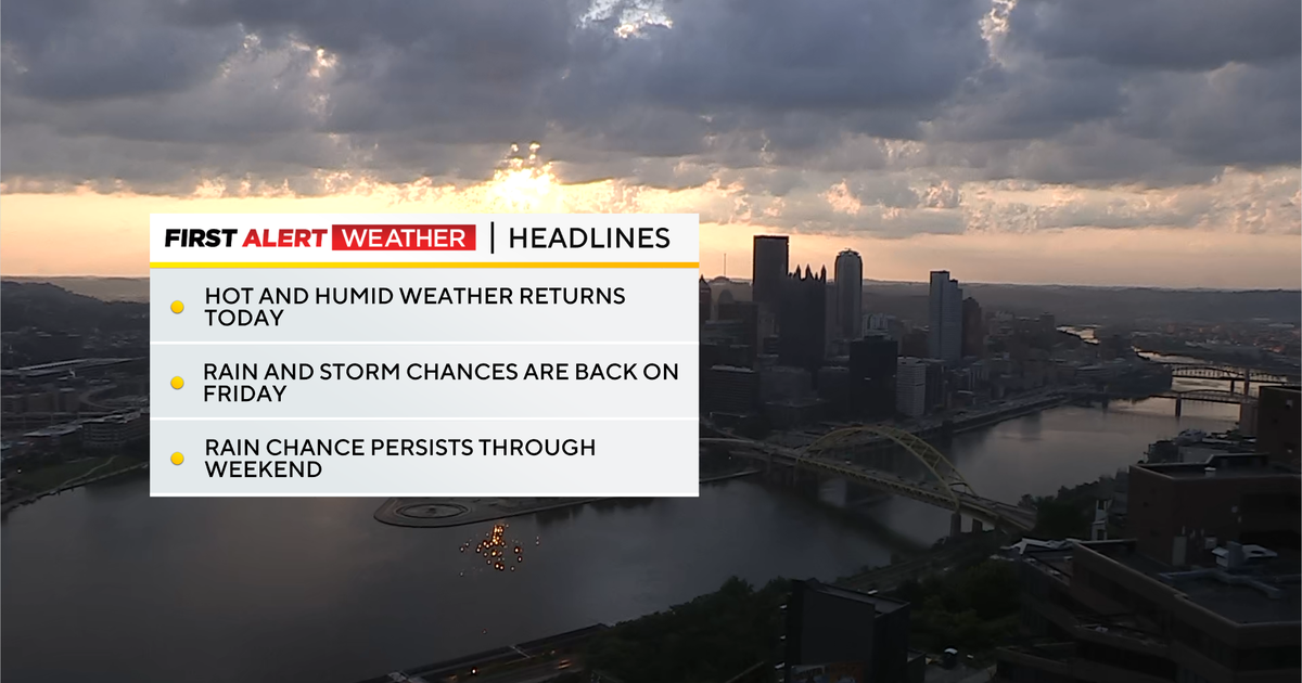
Periods of storms expected this weekend throughout the Pittsburgh area

It's going to be a hot and humid weekend with periods of storms expected to move through the Pittsburgh area.
First Alert: None at the moment
WEATHER LINKS:
Current Conditions | School Closings & Delays | Submit Your Weather Photos
Temperatures once again have struggled to drop below 70 degrees in Pittsburgh early Saturday morning as we are in the midst of an unseasonably warm and very humid air mass. Presently, we are at 18 days this year with a low temperature of 70 degrees or higher, and there is a good chance we could be in second place for the greatest number of 70-degree warm mornings on record at Pittsburgh International Airport by the middle of next week.

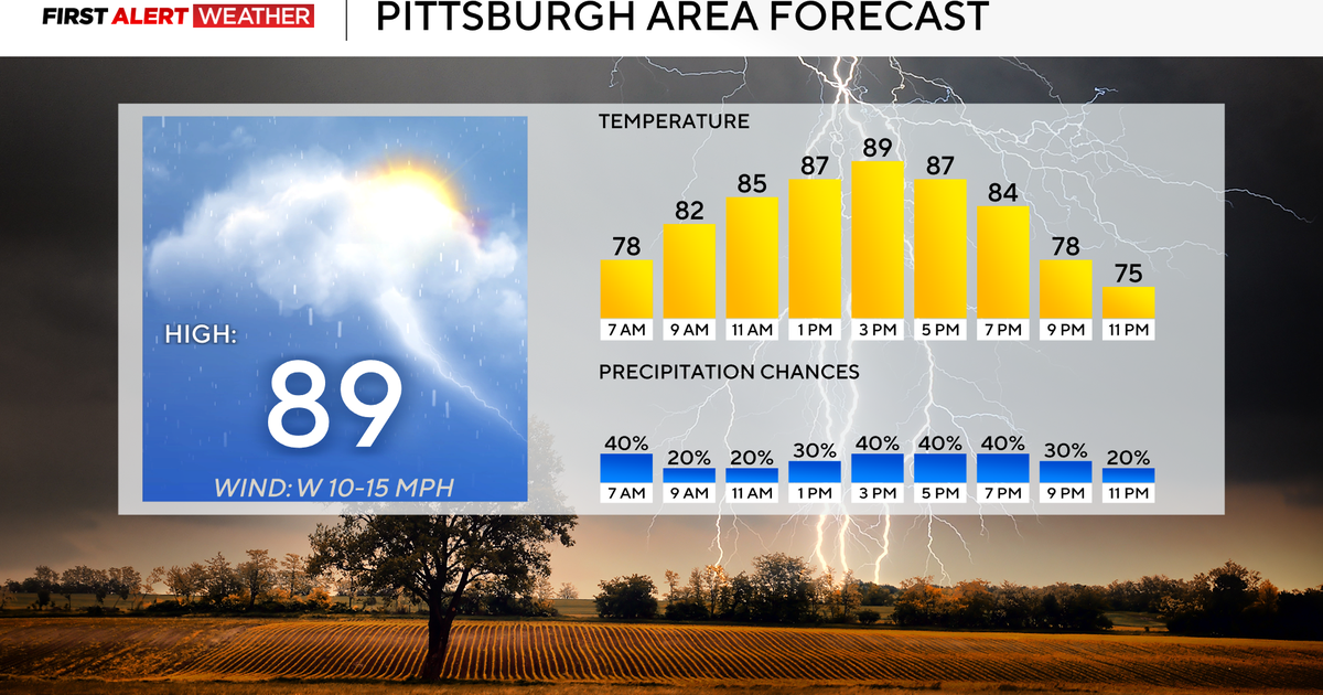
Our large scale weather pattern this weekend will be comprised of continuous heat and humidity accompanied by periods of storms. A frontal boundary has stalled out across our area and will likely meander between the I-70 to I-80 corridors with strong and deep moisture convergence near the boundary. Several impulses aloft in the atmosphere will be moving atop this boundary bringing periods of storms as they pass through. The first of which will move across our area between sunrise and noon today. There will likely be a break in the thunderstorm activity by early to mid afternoon before the next disturbance moves in with increasing shower and storm chances this evening. Temperatures will rise from the lower reach the mid 80s for most by early afternoon. Storms may produce microbursts with wind gusts peaking around 40-60 mph and isolated instances of pea to dime sized hail. Heavy rai and flash flooding will also be a threat with isolated amounts of 2-3" in areas that see repeated storms, but a majority of folks will see around 0.5".
Additional showers and storms are likely overnight as waves of energy pass through. The overall coverage will decrease some with areas mainly north and east of Pittsburgh being favored hotspots for storms. Temperatures will be very warm as well as lows struggle to drop below the low-mid 70s for most. Sunday morning will begin with mostly cloudy skies and a few isolated showers, but it is likely that storm chances will ramp up pretty early in the day—likely before noon as the ground temperature needed to initiate storms will only be in the upper 70s to low 80s. Storm coverage will start to decrease and shift south of Pittsburgh by early evening with clearing skies and areas of fog by Monday morning.
Next week, a series of disturbances rotating around the heat dome parked to our southwest will move our way bringing isolated periodic storm chances. Timing is still fluid with this activity but keep an eye out Monday evening through Tuesday morning.

A stronger cold front is expected to arrive around July 30-31 which will bring near to slightly below normal temperatures accompanied by drier air to our region.