A flash flood risk returns to the Pittsburgh region and will remain through the weekend

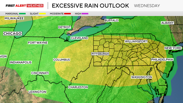
Our area is included under the Weather Prediction Center's Excessive Rain Outlook on each day over the next four days, and today's risk level is a level two out of four.
Near record precipitable water values, along with heat and a mid-level disturbance, will fuel strong storm chances and a flood risk today.
WEATHER LINKS:
Current Conditions | School Closings & Delays | Submit Your Weather Photos
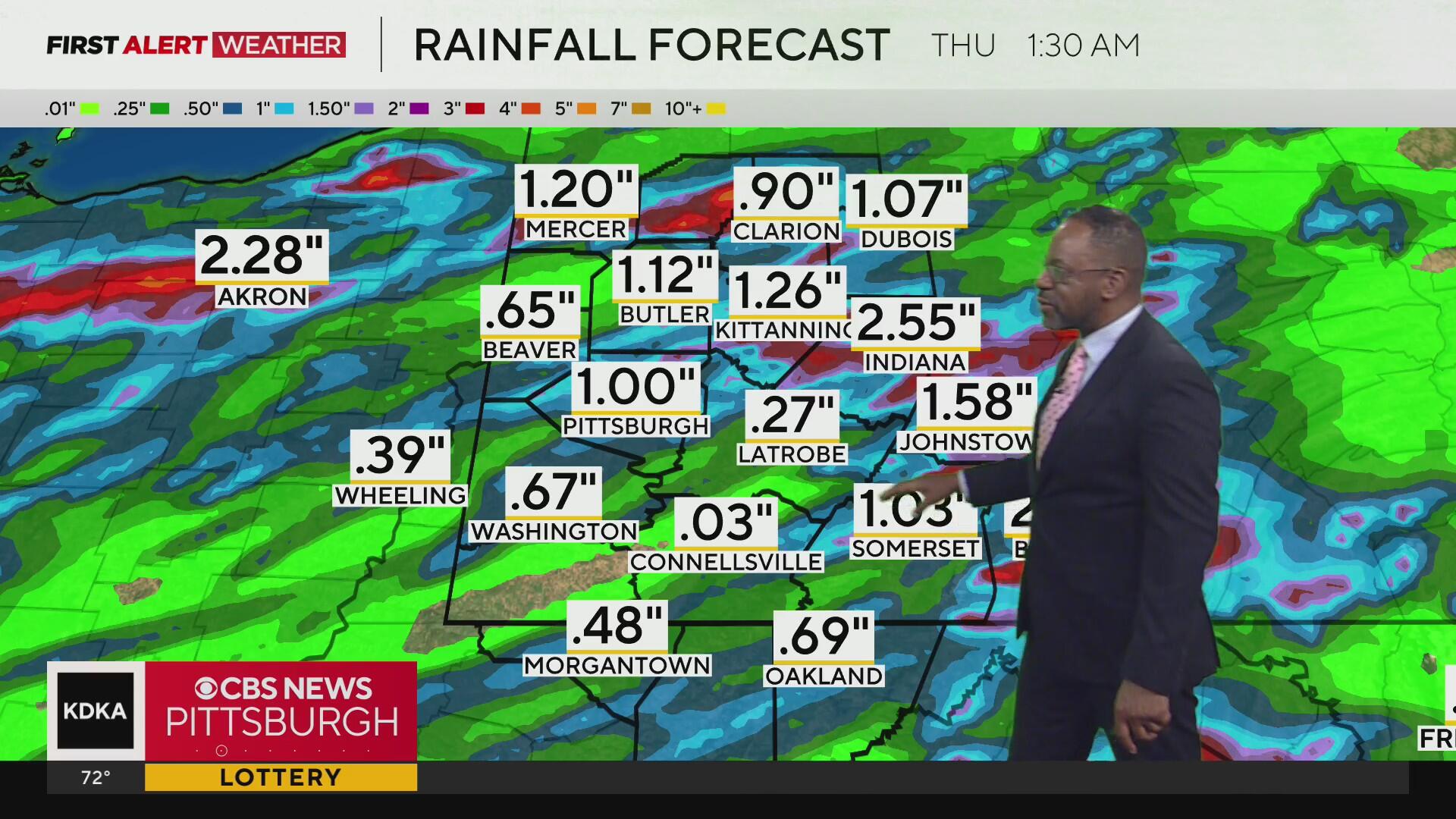
Storms could arrive as soon as 10 a.m. this morning for some parts of our area. Pittsburgh's first rain will likely happen just before noon, with a couple more rounds of rain expected through the afternoon and evening. While most places should see around a half-inch to three-quarters of an inch of rain, there will be standouts that see well over that.
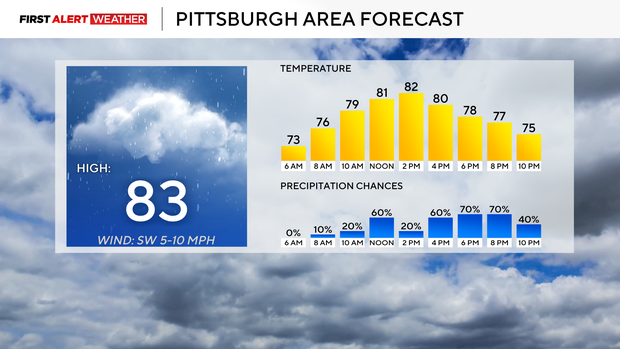
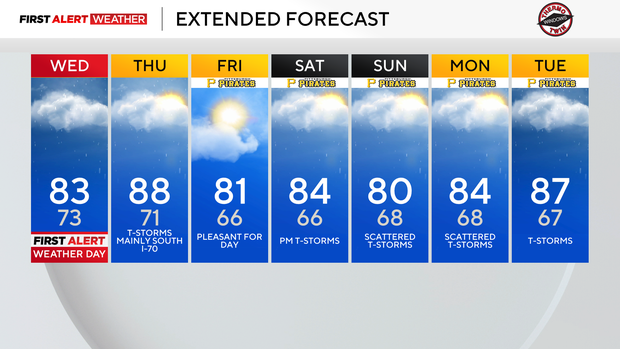
Let's get to your forecast, highs today will hit the mid to low 80s due to rain. I have Pittsburgh's high hitting 83°. Rain chances will be highest from 5 p.m.-9 p.m., but even outside of that window, people will see rain. I have noon temperatures in the low 80s.
Thursday highs are expected to hit the upper 80s in Pittsburgh, with the highest chance for rain on Thursday occurring in places south of I-70. Friday is looking VERY comfy with highs in the low 80s and humidity levels a tick or two lower than today's. Saturday and Sunday temperatures will be in the mid to low 80s.
The setup is a similar one to what we have seen over the past two months here locally. High moisture levels in the atmosphere, with us seeing precipitable water levels in the 90th percentile on record. The latest Pittsburgh NWS sounding shows yesterday's PW at 1.65".
It will be interesting to see what this morning's sounding shows, and I expect we will see our PW values close but still shy of the record daily value of 2.05".
Why does this matter? The higher the PW value, the higher the chance of seeing life-threatening flash flooding. On top of the moisture, we will have the trigger in the way of a mid-level low that will roll by today. This will all come together to bring heavy but fairly fast-moving storms our way this afternoon.
The risk for flash flooding won't just be confined to today, as data shows the risk for flash flooding remaining in place Thursday, Friday, Saturday, and likely on Sunday too. There will be some big gaps in the rain, though, including most of Friday, looking dry and pleasant.
At this point, only today has been named a First Alert Weather Day, but I expect us KDKA meteorologist will be issuing another FAWD or two before the weekend is over.
Stay up to date with the KDKA Mobile App – which you can download here!