Periods of rain and storms with some localized flooding possible in Pittsburgh this weekend

Parts of Western Pennsylvania received some very heavy rain through the overnight hours. A swath of 1-4+" occurred from areas near Plum to Vandergrift to Indiana, which resulted in a Flash Flood Warning being issued in those areas during the overnight hours. There was also a maximum of heavy rain with radar estimates of 1-3" around the New Castle area.
WEATHER LINKS:
Current Conditions | School Closings & Delays | Submit Your Weather Photos
This morning, a stalled frontal boundary continues to remain in place across Western Pennsylvania, with the boundary draped between I-70 and HW 422. A weak low-level wind just above the surface continues to transport rich moisture into the frontal zone, resulting in rising air and waves of showers and thunderstorms.
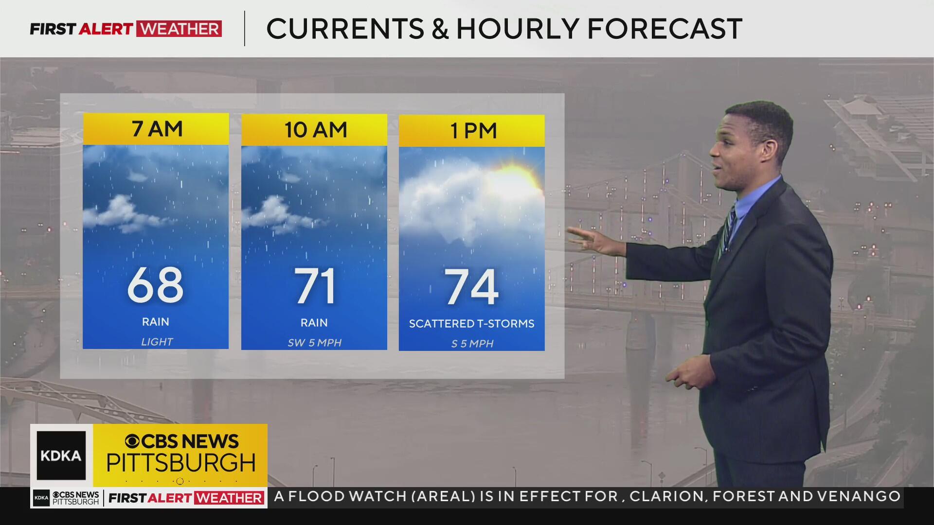
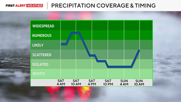
For Saturday morning through early afternoon, we expect a numerous to widespread coverage of rain and storms from roughly the Pittsburgh metro area north toward I-80. After 12-1 p.m., the coverage for areas north of Pittsburgh will start to slowly diminish, with more scattered storms developing south of Pittsburgh toward I-70 & I-68.
Any of these cells will produce locally heavy rainfall with the potential for flash flooding.
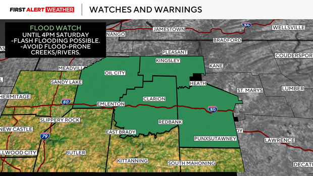
As of now, high-resolution modeling suggests a zone of 1-3" occurring between Pittsburgh and I-80 through early Saturday afternoon. This zone could shift depending on storm behavior, and if the front shifts slightly, but folks should be on the lookout for flash flooding. A Flood Watch is in effect until 4 p.m. for Clarion, Venango, Forest, and Jefferson counties.
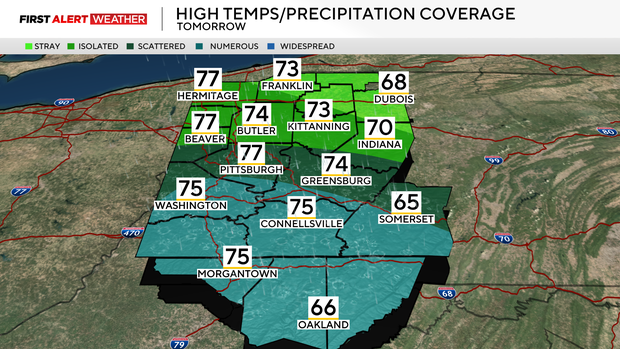
For Saturday night into Sunday, the best chance of rain and storms will start to shift toward our southern counties. There will likely be some patchy fog on Sunday morning as well. By midday Sunday into Sunday afternoon, the best chance for rain will likely align from Pittsburgh and points south toward our I-70 and I-68 counties.
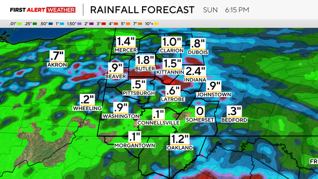
Coverage will be more scattered on Sunday compared to Saturday, so not everyone will see rain, but those that do could easily receive a quick 1-2" with the potential of localized flooding.
Rain and storm chances will be lowest next Monday and Tuesday as we won't have much of a strong trigger or source of lift in our area. Isolated showers and storms will develop during the heat of the day. However, models are suggesting we move into a pattern by mid-late next week that will deliver a stronger jet stream punch and a trough of low pressure by Wednesday and Thursday.
This will amp up rain chances once again, and possibly a few strong to severe storms. A push of drier air will move in from the northwest toward the end of the week, bringing an end to the heavy rain potential.

Stay up to date with the KDKA Mobile App – which you can download here!


