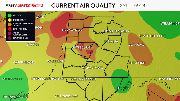
Fireworks smoke and haze linger on Saturday morning in Pittsburgh as hot weather looms

Lingering fireworks smoke from Friday night has led to unhealthy air quality across most of Western Pennsylvania and the Ohio Valley/Great Lakes states early Saturday morning.
WEATHER LINKS:
Current Conditions | School Closings & Delays | Submit Your Weather Photos
This smoke is trapped near the surface due to light winds and a temperature inversion, which prevents air near the surface from rising and mixing vertically.
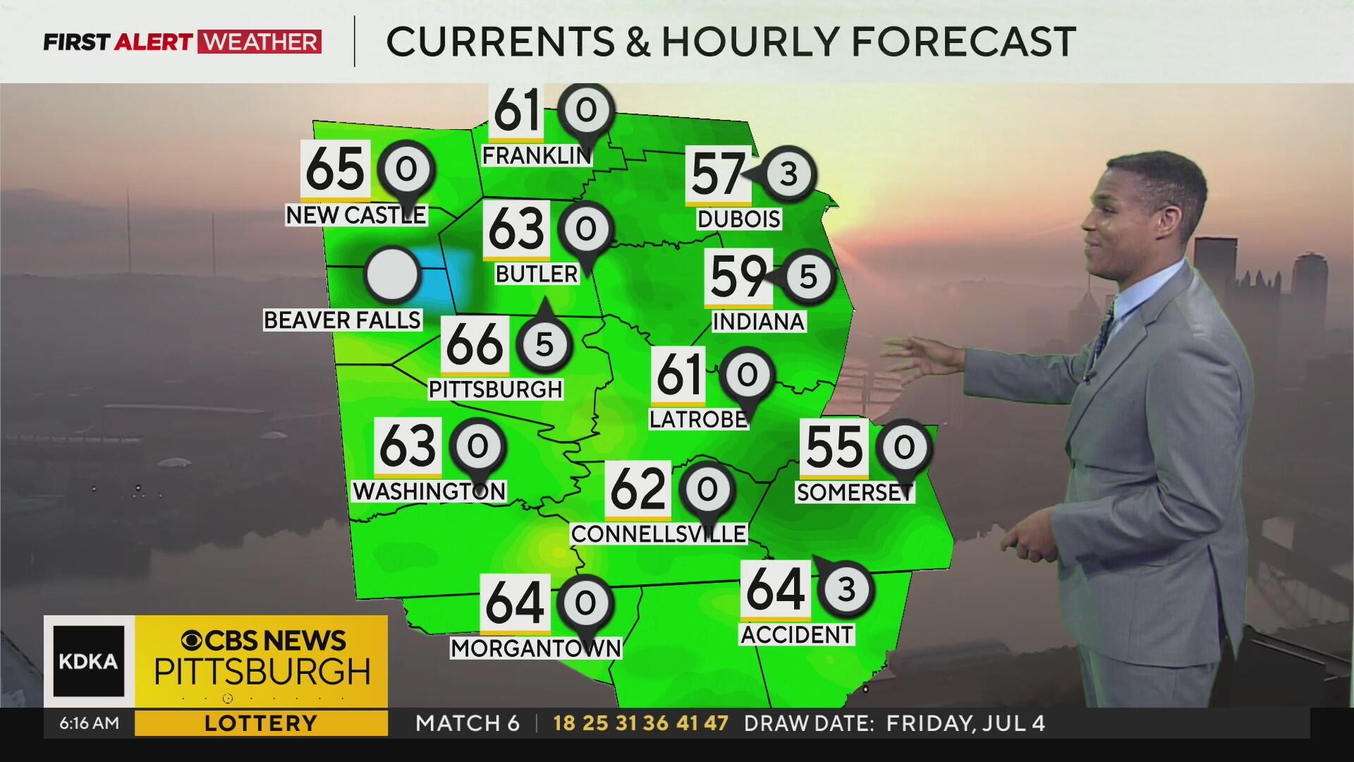
This smoke will continue to be an issue through mid-morning until the low levels heat up enough to mix some of it out, with lingering hazy skies expected the rest of the day.
As high pressure moves east and winds shift to the southwest, we expect a warmer air mass to move in from the southwest today as well. Our region will be fixated within a ridge of high pressure and a potential tropical system moving ashore to the Carolinas Saturday into Sunday, which will amplify sinking air aloft, leaving us with mostly sunny to partly cloudy skies and overall dry conditions.
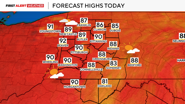
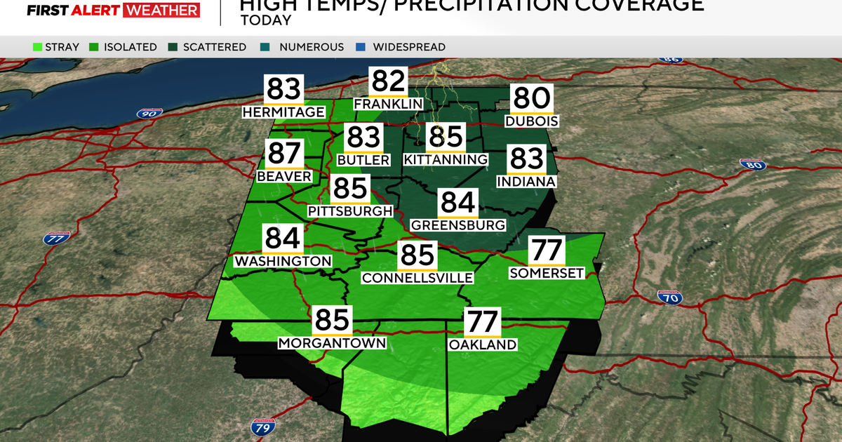
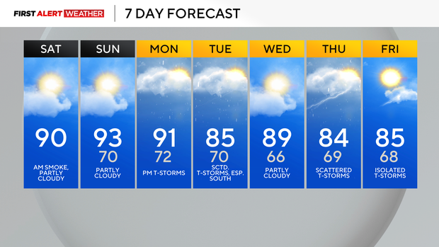
Highs on Saturday and Sunday are expected to be in the upper 80s to near 90, with the most likely days to reach 90°F or higher being Sunday and Monday. Dew points will be elevated during the early morning hours, but drop in the afternoon thanks to drier air mixing aloft, which should help prevent heat indices from reaching hazardous levels.
Individuals should still stay well hydrated while being outdoors, and those sensitive to the heat should take frequent breaks or avoid being outside during the hottest part of the day.
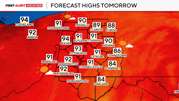
One more hot afternoon is expected Monday ahead of a weak trough moving in from the northwest by early evening. Some isolated to widely scattered storms appear likely to develop along this system's advancing front, but coverage doesn't look too great right now, mainly due to weak amounts of lift.
Gusty outflow winds and locally heavy rain will be possible with any storm, but widespread severe weather is not expected. The system that brings the rain chance Monday evening should dissipate just south of our area Tuesday and Wednesday, with a remnant storm chance during peak heating both days.
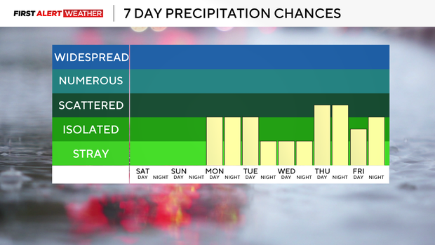
Another system with higher levels of moisture and better rain chances may approach by the end of next week.
Stay up to date with the KDKA Mobile App – which you can download here!