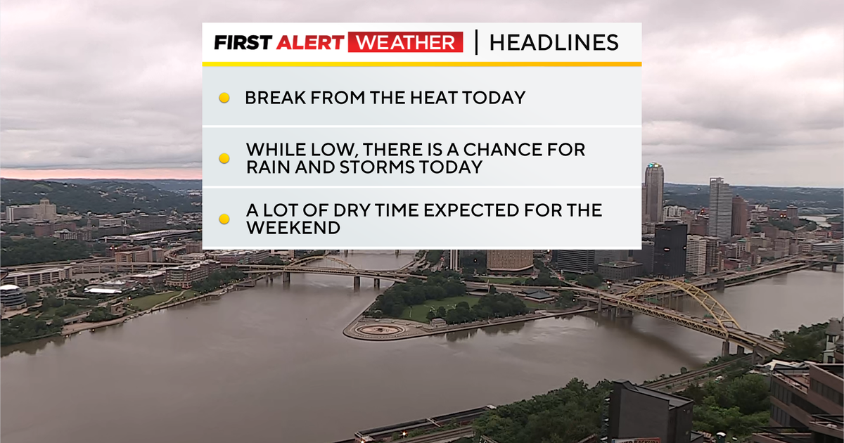
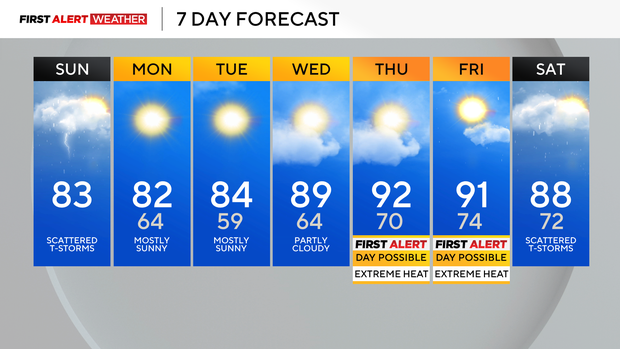
Sunday is a comfortable start to the week before sweltering heat returns to Pittsburgh area

Last night into this morning's thunderstorm complex did not fully materialize as well as previously anticipated. Some mid-level dry air likely played a role in keeping activity less widespread.
WEATHER LINKS:
Current Conditions | School Closings & Delays | Submit Your Weather Photos
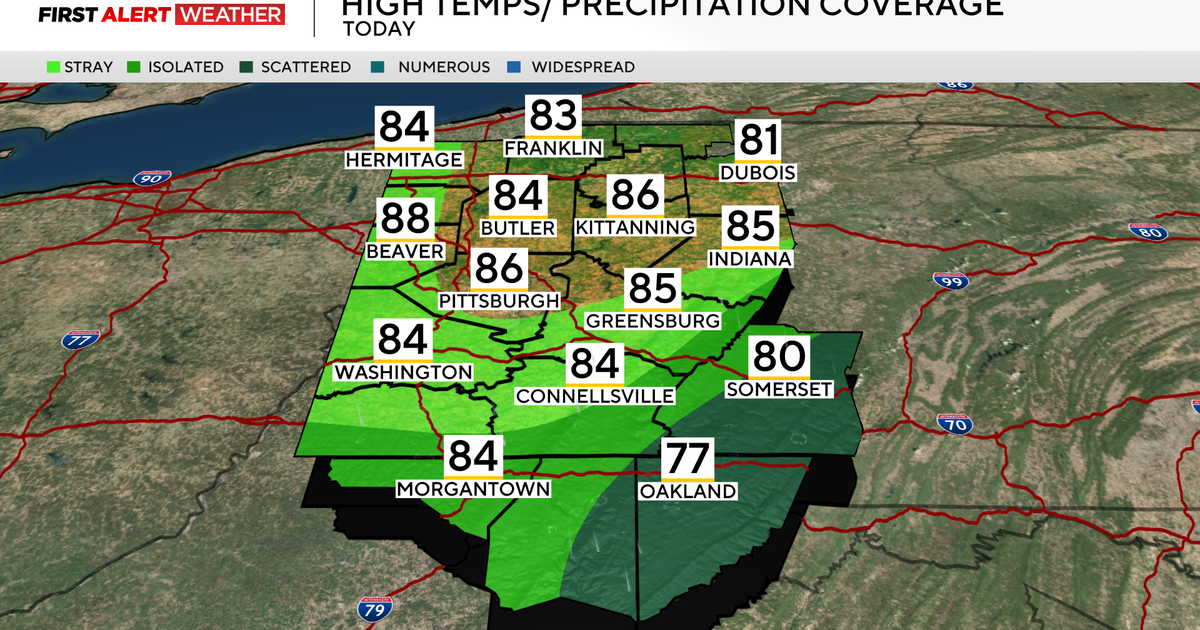
Still, there are some scattered showers moving across our area this morning, along with a few isolated storms into northern portions of West Virginia. All of Western Pennsylvania remains within a very warm and humid air mass and will continue to do so through the early to late evening hours of Sunday.
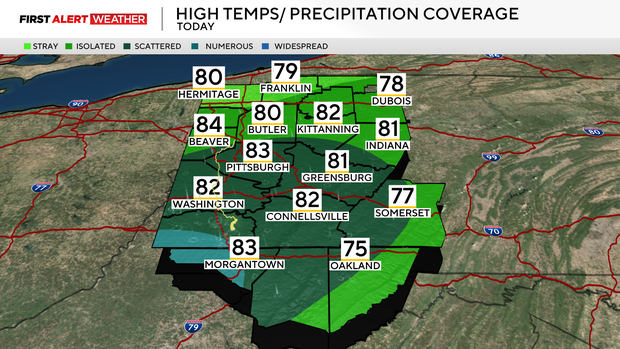
A cold front will be moving in from the northwest and enter our northwest counties around 2 p.m., Pittsburgh metro by 6-7 p.m., and Northern West Virginia by 3-4 a.m. Monday. Some additional isolated to widely scattered storms are expected with the front as it progresses southeast this afternoon and early evening. While the front will be moving from northwest to southeast, any thunderstorm cells will move from west to east and should move quickly enough to preclude a flash flood threat.
Coverage will overall be limited as well since winds along the front will not be converging strongly. Areas from the Pittsburgh metro and points south and west have the highest chance of rain.
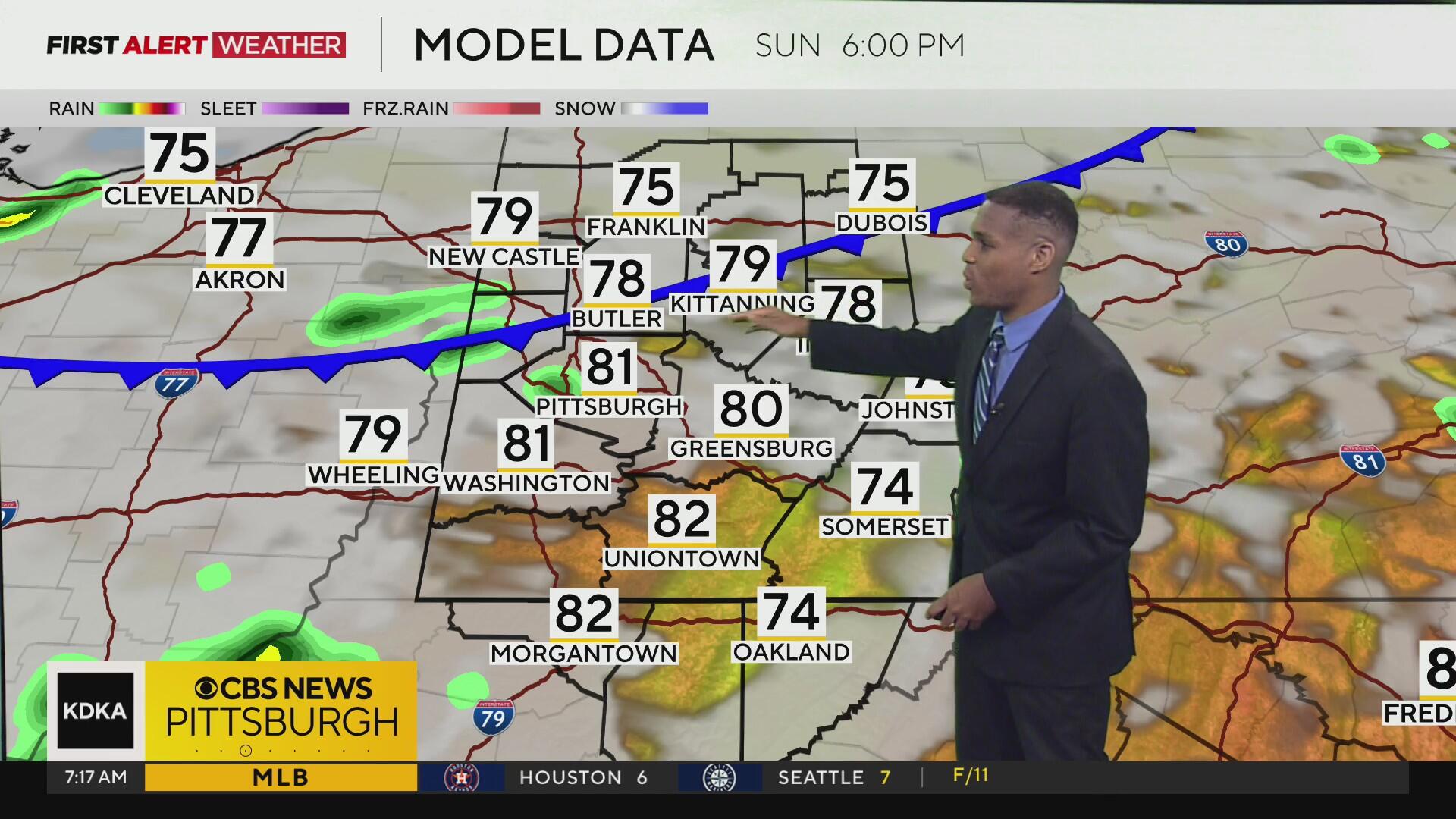
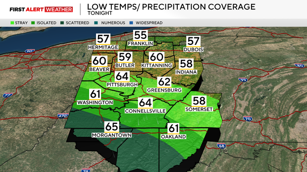
Drier and cooler air will filter in Monday morning, leading to a gradual decrease in clouds. Morning lows on Monday and Tuesday will be refreshing, with most of our area in the upper 50s to low 60s and highs in the upper 70s to low 80s, which is closer to normal for this time of year.
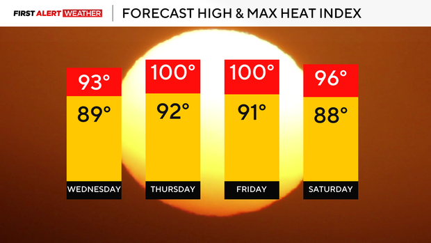
This brief break in the excessively humid and hot conditions will be very short-lived as winds begin to flip around to the southwest by Wednesday afternoon. Temperatures will respond by warming into the upper 80s to near 90 for highs on Wednesday.
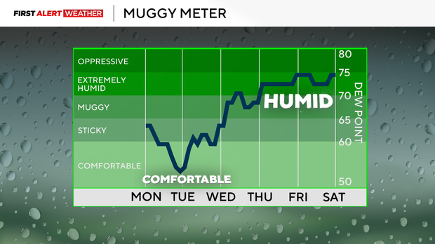
Thursday and Friday will likely both exceed 90 degrees for air temperatures as a strong upper-level high migrates east to our region and low-level winds transport hot air into Western Pennsylvania from states to the southwest. Evaporation of moisture from soils and trees should help keep air temperatures only in the low 90s, but this added moisture will make for dangerous heat indices near 100 degrees Thursday and Friday afternoon and evening.
The high levels of moisture will keep air temperatures from dropping much at night, with lows in the low to mid 70s, especially in the core of the urban heat island of Pittsburgh. It is likely that the National Weather Service Pittsburgh Office will issue a Heat Advisory to account for this potential.
The upper high or heat dome will begin to weaken by Friday and allow a couple of weak disturbances to slip in, leading to storm chances by late Friday and Saturday.
Given the amounts of heat and moisture that will be in place, there will be plenty of instability to possibly support a severe storm potential as well.
Stay up to date with the KDKA Mobile App – which you can download here!