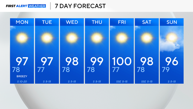
Summer temperatures sticking around for North Texas, with heat indexes topping 100 this week

The high Sunday was again just below normal for the season, 95°, normal is 96°.
So far this July, we've only suffered two days of above-normal highs, an indication that the worst of the summer heat hasn't arrived yet.
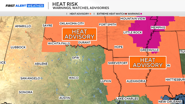
Looking at the 30-year climatology for DFW, our "peak heat" runs July 23 through August 14. The "normal" high peaks are at 97° for this time period. Summer heat is at our borders to the north and east.
This appears to be the week that the heat of summer truly arrives. The hottest day logged at DFW so far this summer is 97°. We are forecasting that mark and higher to start the week.
It seems the lack of dominant high pressure and soil moisture has kept this level of heat at bay until now.
We think by the end of the week, both will swing in favor of hotter temperatures. We might have our first 100° of the year by Friday. After that, the high-pressure ridge bringing this heat starts to move northwest of us, allowing Gulf moisture to enter, bringing clouds and tempering the heat somewhat.