Storms ease before Fourth of July fireworks, but flood risk lingers in South Florida

Scattered showers and storms are expected to continue this Friday into the early evening hours across South Florida, but activity will become isolated later in the evening and overnight, according to the NEXT Weather team.
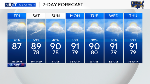
While a few stray showers can't be ruled out, most of the rain is expected to wrap up ahead of Fourth of July firework shows Friday night. Skies will remain mostly cloudy, with temperatures hovering in the upper 70s to low 80s. A localized flood risk remains in areas that saw heavy downpours earlier in the day.
Fourth of July storms expected to clear by fireworks time
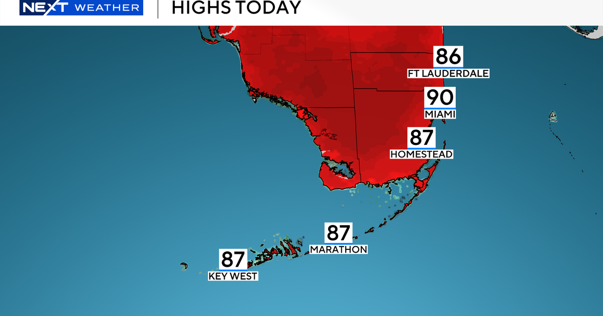
Earlier in the day, storms developed after a mainly dry morning, fueled by daytime heating and a moist atmosphere. The issued a Level 1 (Marginal Risk) for flooding in isolated spots. Afternoon highs reached the upper 80s.
Beachgoers were greeted with cloudy skies and scattered storms. It was not an ideal beach day, though the risk of rip currents remained low. The UV index was very high, and while there were no alerts for boaters, they were urged to watch for passing storms through the afternoon and evening.
Fourth of July weekend rain chances linger across South Florida
Looking ahead to the weekend, umbrella-worthy weather continues.
Scattered showers and storms are forecast for both Saturday and Sunday, with rain chances ranging from 40% to 60%. On Saturday, models favor rain during the late morning through midday, with a drying trend later in the day. Afternoon highs will climb to the upper 80s Saturday and around 90 on Sunday. Isolated storms will also be possible over the Atlantic waters and near the Keys on Saturday, though no marine advisories are in effect.
By early next week, a drier weather pattern takes hold. Isolated showers are still possible, but the rain chance drops to just 20% Monday and Tuesday. With less rain, temperatures will return to near 90 degrees in the afternoons.