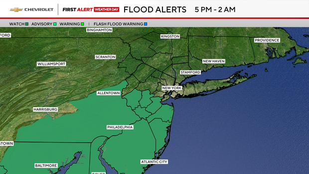
First Alert Weather Day issued for Tri-State Area due to heat, storms

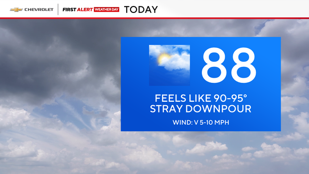
As far as Wednesday's forecast goes, we were greeted by another muggy morning with temperatures that reached the upper 80s in the afternoon. When you factor in the humidity, it felt more like the low to mid 90s.
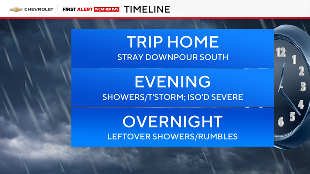
But it's in the evening when we'll see another round of showers and thunderstorms develop, particularly off to our south.
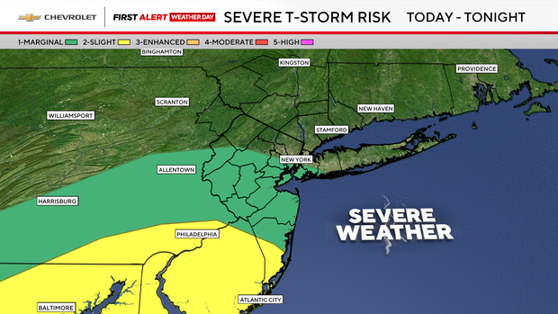
These storms will be capable of producing flooding rains, and even locally damaging winds.
The activity looks to wind down overnight, with showers exiting until as late as dawn.
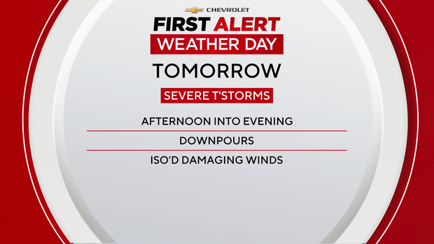
We're back at it Thursday, as we've issued yet another First Alert Weather Day, due to the threat of severe thunderstorms and flooding rains.
As far as the timing goes, storms will fire up a little sooner, in the afternoon; then it's hit and miss after that, with things quieting down into the evening.
There's still a chance of showers and thunderstorms on Friday, but it doesn't look quite as active.