Friday in Philadelphia region starts foggy with chance of isolated storms. Here's the forecast.

Once again, heavy rain prompted flash flood warnings across South Jersey west into Central Delaware, but just as the sun set Thursday night, the rain cleared and the sunshine returns for many across the region.
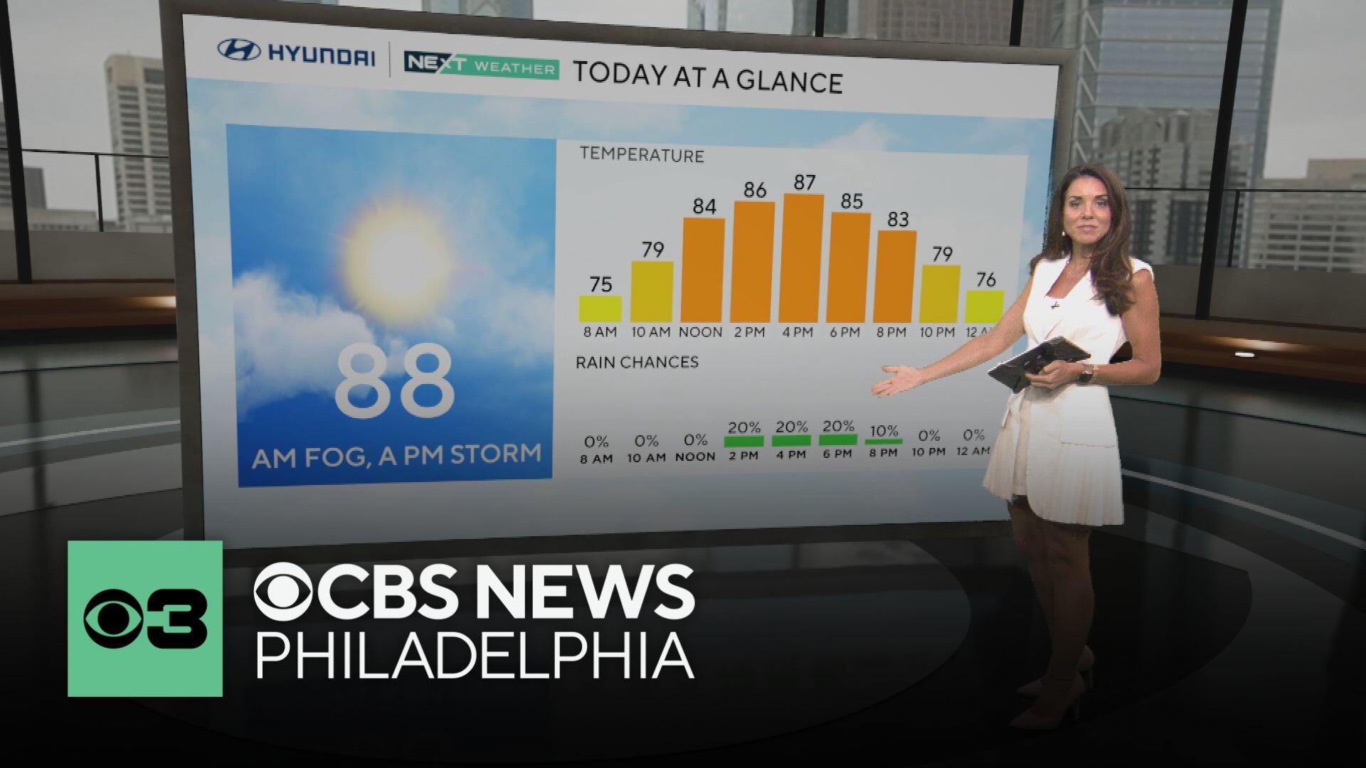
Friday morning, areas of fog are developing in Delaware and toward the Jersey Shore after morning temperatures bottomed out around 70 degrees.
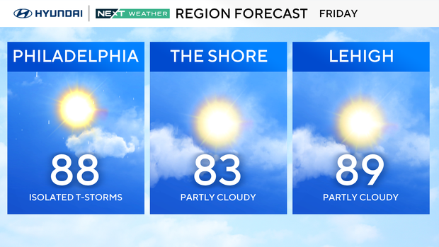
As temperatures rise, the fog will mix out and give way to mostly sunny to partly cloudy skies. Temperatures will then rebound back into the upper 80s with our old friend humidity making it still feel like the low-middle 90s.
For a change, however, the chance of rain Friday afternoon will be considerably lower than what the area has had all week with only a few isolated showers or storms possible through the afternoon. Any storms that do pop during this time could bring a brief bout of heavy rain.
The chance of rain will decrease through the evening as temperatures once again gradually drop back into the low 70s to start off the weekend.
We won't completely drop the chance of rain for the weekend, there looks to only be a small chance for a few pop-up afternoon showers or storms both Saturday and Sunday, with high temperatures in the upper 80s to right around 90 degrees both days.
A cold front is pegged to sweep through the region Monday, which will bring the chance for more widespread showers and thunderstorms. Otherwise, once that front moves through, a calmer pattern should return for most of next week.
Here's your 7-day forecast:
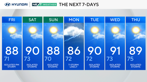
Friday: Isolated p.m. storm. High 88, Low 71
Saturday: Isolated storms. High 90, Low 73
Sunday: Isolated storms. High 88, Low 70
Monday: T-storm likely. High 86, Low 72
Tuesday: Isolated storms. High 90, Low 72
Wednesday: Isolated storms. High 91, Low 73
Thursday: Isolated storms. High 89, low 75.