Rain chances return to the Pittsburgh area today

Rain chances will be returning for the Pittsburgh area today with humidity levels set to drop tomorrow.
Any Alert Days Ahead? There's a chance for Saturday. Data has been all over the place though, so we will see.
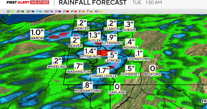
Aware: We had a couple of places record more than 2" of rain yesterday, including the Grove City area in Mercer County, Chicora in eastern Butler County, and North of W. Middletown in Washington County.
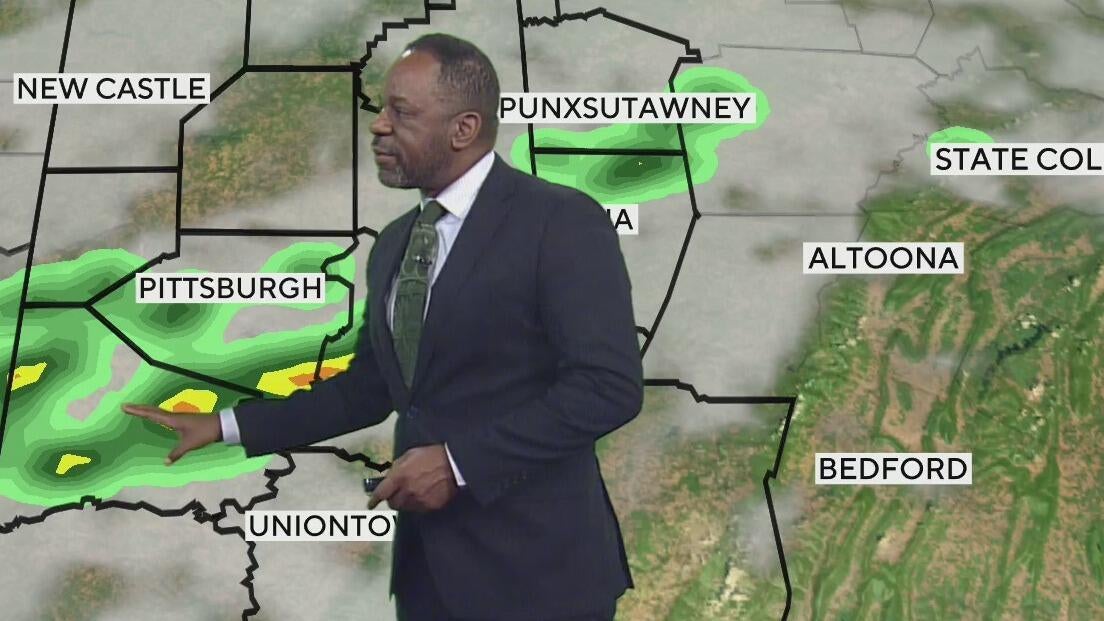
A cold front finishes what it started this morning and early afternoon, finally clearing out of our area. The front stalled in the overnight hours and is located just south of the Pittsburgh airport, but north of downtown Pittsburgh as of 5a this morning. As it works its way to the southeast this morning into the early afternoon, we will see a thin line of showers and then storms moving along I-70 and places south of there. This is also the area that is still included under a low level 1 out of 4.
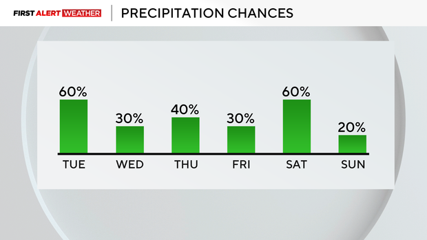
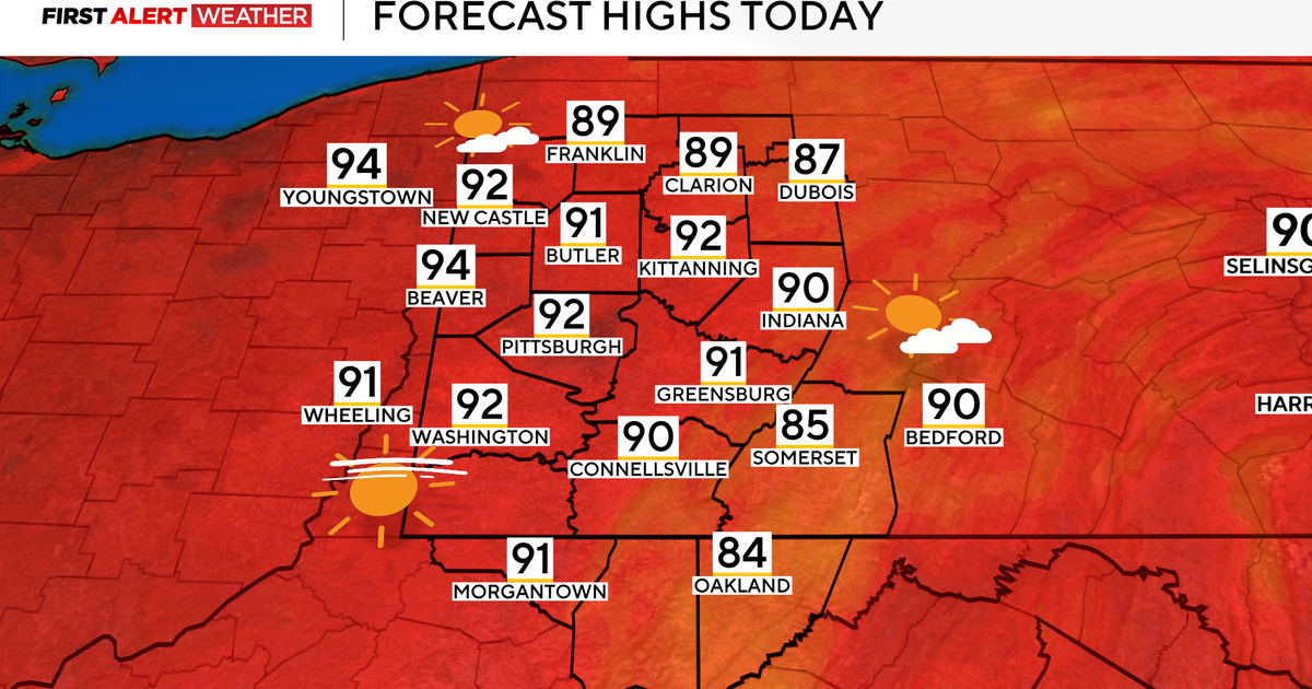
Right now, it looks like rain chances will be highest from 9 a.m. through 4 p.m. today. This puts the best chance for rain falling outside both the morning and the evening commutes. In Pittsburgh, highs today should hit the low 80s. The day will start off humid, but the afternoon hours should be more comfortable. I have noon temperatures in the upper 70s, and our daily low temperature will probably be hit at midnight. I have our daily low temperature at 69°.
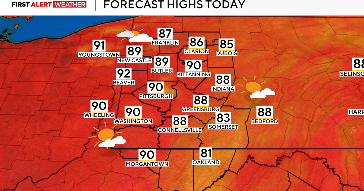
Wednesday highs will hit the mid-80s, but humidity levels will be slightly down. It should feel pretty good.
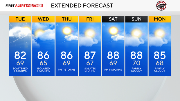
Thursday highs will also be in the mid 80s before we see highs closer to the upper 80s on Friday, Saturday, and Sunday.
WEATHER LINKS:
Current Conditions | School Closings & Delays | Submit Your Weather Photos