Dangerous heat lingers around North Texas as work week begins

We kicked off the workweek with a high temperature of 97°, which is exactly average for this point in the year.
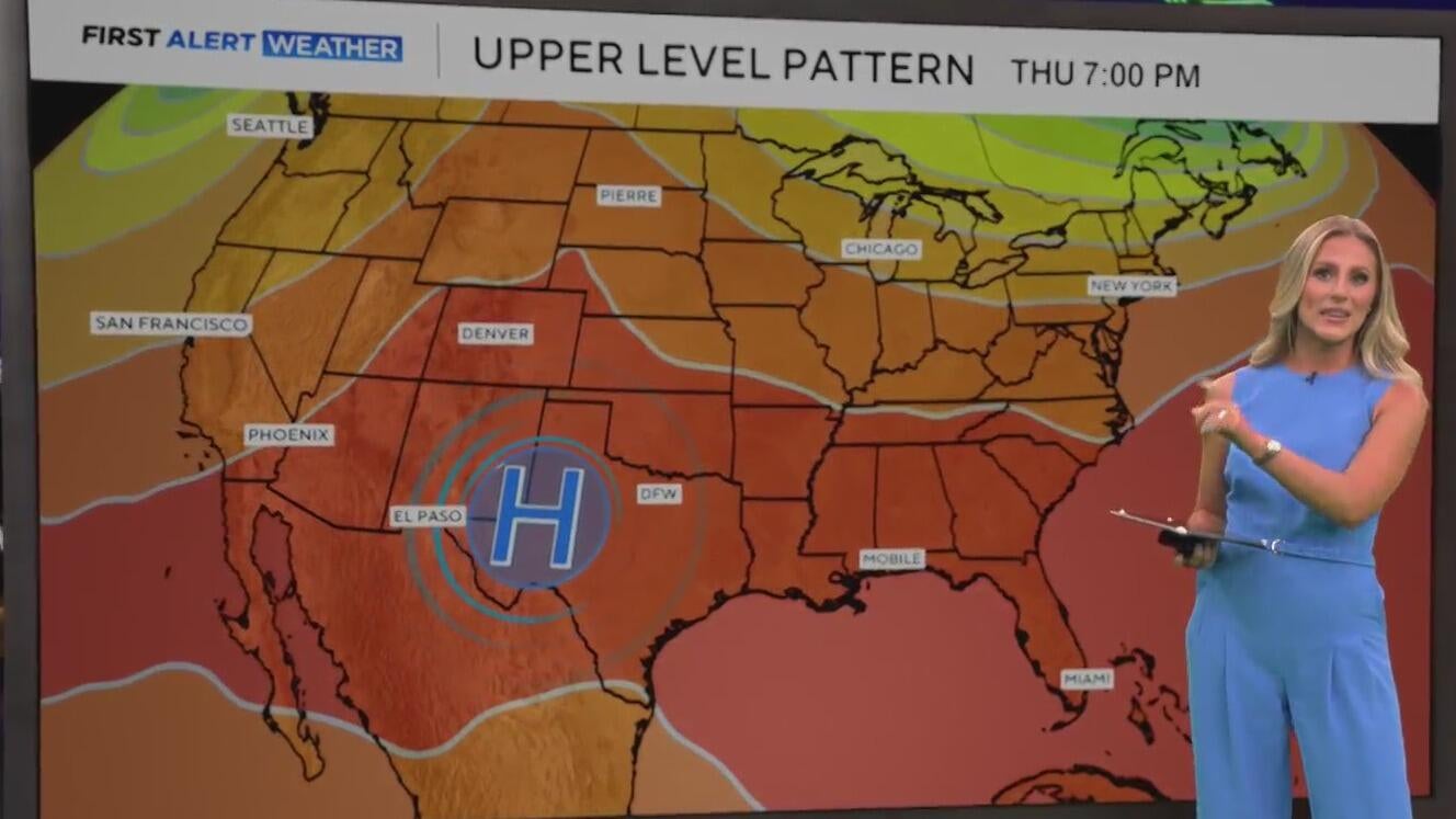
The next few days, though, things start to heat up. This is as a ridge of high pressure moves to the west, right over North Texas, and eventually to the west of us.
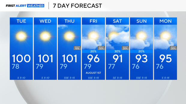
As a result, I think we will finally see our first triple-digit day of the year at DFW, which is where our records are kept.
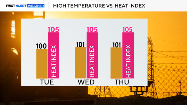
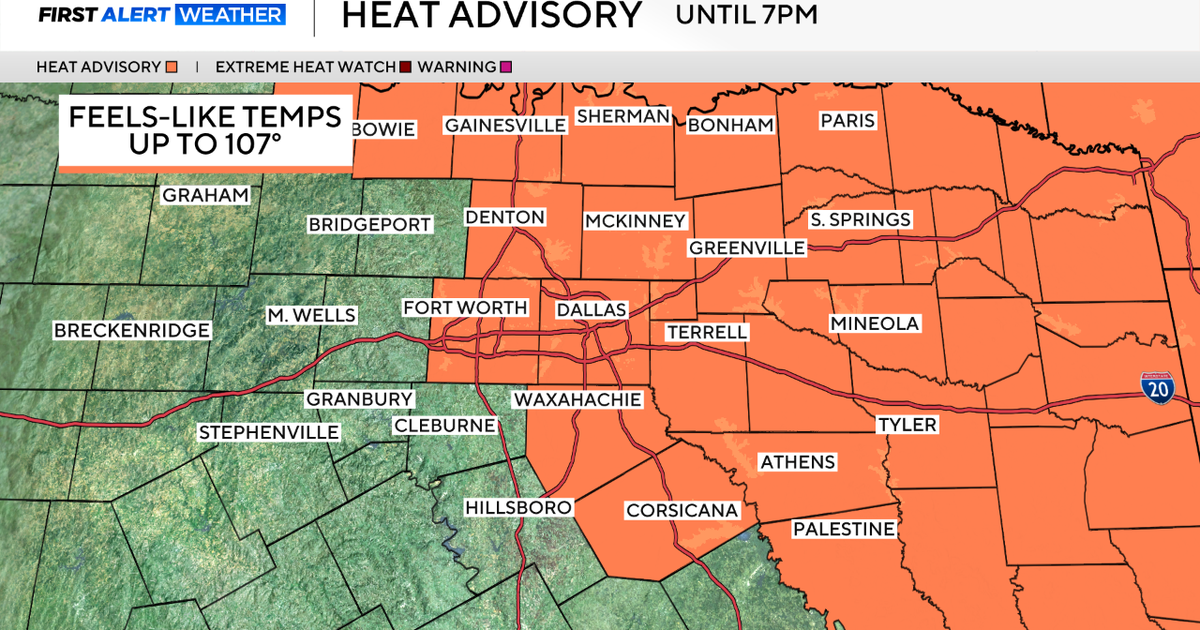
Expect a stretch of triple-digit days, with feels-like temperatures slightly hotter.
Fortunately, dew points will be much lower than they were over the weekend, so while it will be hot, it won't be too oppressively humid outside.
As we head into the end of the week and this weekend, a weak cold front starts to slide into the region.
This will bring the chance for isolated to scattered rain showers Friday afternoon and evening, and then once again on Saturday.
This will also bring a slight "cool down" with temperatures falling into the lower 90s for the weekend, before heating up next week.